Katana VentraIP

Appian Way

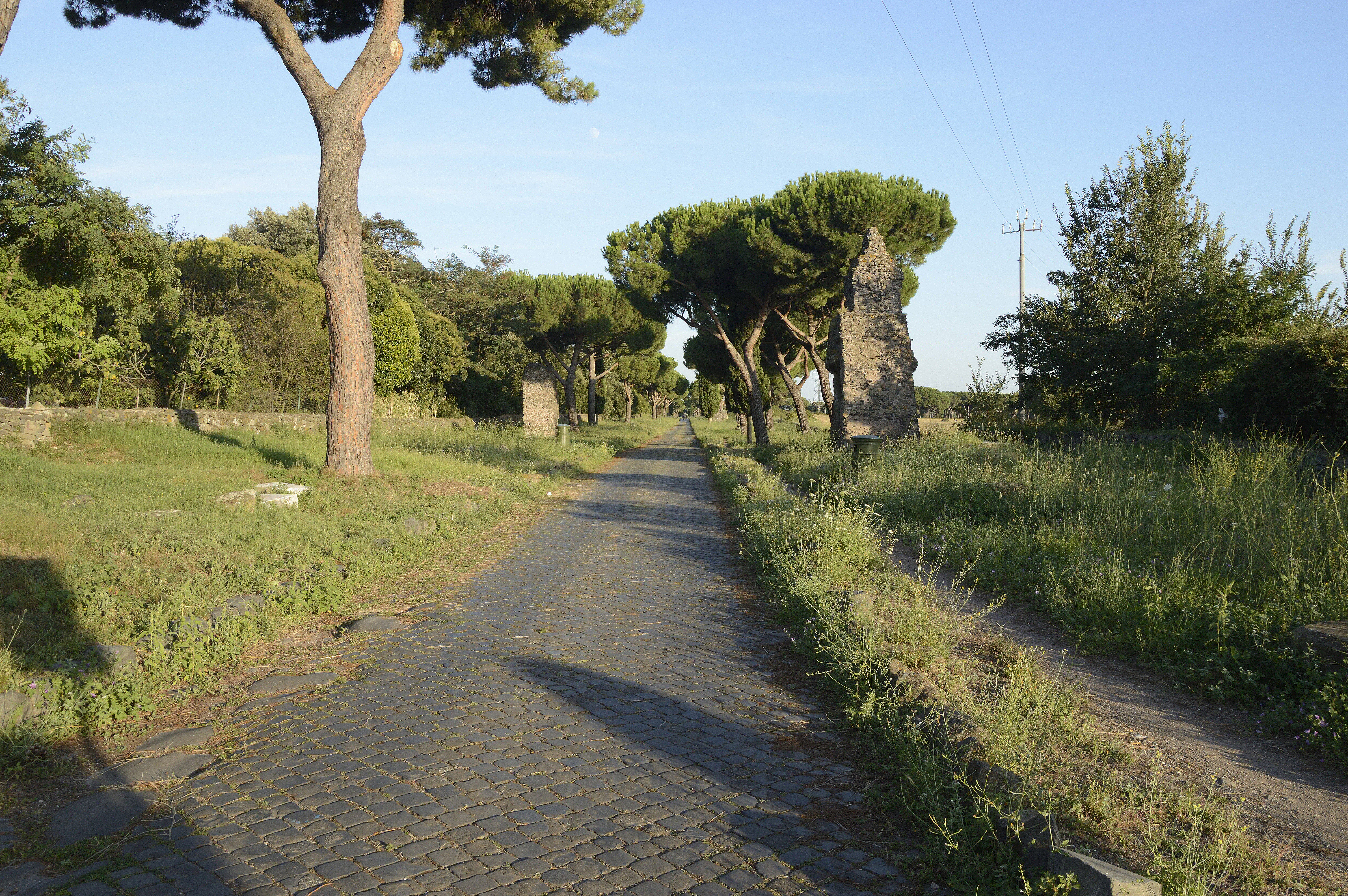
The Appian Way (Latin and Italian: Via Appia) is one of the earliest and strategically most important Roman roads of the ancient republic. It connected Rome to Brindisi, in southeast Italy.[1] Its importance is indicated by its common name, recorded by Statius,[2][3] of Appia longarum... regina viarum ("the Appian Way, the queen of the long roads"). The road is named after Appius Claudius Caecus,[4] the Roman censor who, during the Samnite Wars, began and completed the first section as a military road to the south in 312 BC.[5]

This article is about the ancient Roman road. For other uses, see Appian Way (disambiguation).

Location

Porta Appia (), the gate of the Aurelian Walls

Porta San Sebastiano

Church of Domine Quo Vadis

Tomb of Priscilla

Catacomb of Callixtus

Hypogeum of Vibia

San Sebastiano fuori le mura

Catacombs of St Sebastian

Vigna Randanini Jewish catacombs

Circus of Maxentius

Tomb of Caecilia Metella

Roman baths of

Capo di Bove

Tomb of Hilarus Fuscus

Appian Way Regional Park

– which borders the northern side of the Appian Way

Park of the Caffarella

Roman bridge

Roman engineering

Three Taverns

– a movement of Ottorino Respighi's tone poem Pines of Rome

The Pines of the Appian Way

Berechman, Joseph. 2003. "Transportation – Economic Aspects of Roman Highway Development: The Case of Via Appia". Transportation Research Part A 37, no. 5: 453–78.

Coarelli, Filippo. 2007. Rome and environs: An archaeological guide. Translated by James J. Clauss and Daniel P. Harmon. Berkeley: Univ. of California Press.

Della Portella, Ivana. 2004. The Appian Way: From Its Foundation to the Middle Ages. Los Angeles: J. Paul Getty Museum.

Dubbini, Rachele. 2016. "A New Republican Temple on the Via Appia, at the Borders of Rome's Urban Space". Journal of Roman Archaeology 29: 327–47.

Kleijn, M. de, R. de Hond, and O. Martinez-Rubi. 2016. "A 3D Spatial Data Infrastructure for Mapping the Via Appia". Digital Applications in Archaeology and Cultural Heritage 3: 23–32.

Magli, Giulio, Eugenio Realini, Mirko Reguzzoni, and Daniele Sampietro. 2014. "Uncovering a Masterpiece of Roman Engineering: The Project of Via Appia between Colle Pardo and Terracina". Journal of Cultural Heritage 15, no. 6: 665–69.

Peterson, John. 2015. "Modelling Roman surveying in the Pontine plain". 1st International Conference on Metrology for Archaeology Benevento, Italy, 22–23 October 2015 445–9.

Luciano Piepoli (2014). . Vetera Christianorum (in Italian) (51): 239–261.

"Il percorso della via Appia antica nell'Apulia et Calabria: stato dell'arte e nuove acquisizioni sul tratto Gravina-Taranto"

. La via Appia attraverso l'Apulia e un singolare gruppo di strade "orientate" (PDF) (in Italian). Archived (PDF) from the original on 29 December 2021.

Giuseppe Lugli

Smith, William (1854). . London.{{cite book}}: CS1 maint: location missing publisher (link)

Dictionary of Greek and Roman Geography

Edit this at Wikidata

Official website

Appian Way Regional Park

Ivana Della Portella, Giuseppina Pisani Sartorio, Francesca Ventre. The Appian Way: From Its Foundation to the Middle Ages. Los Angeles, 2004 (Google Books Preview).

Via Appia Antica From Torre In Selci To Frattocchie

Via Appia Antica From Cecilia Metella To Torre In Selci

The Via Appia And The Cities Of The Pontine Plain

Documentary Film about the Sassi di Matera and the Appian Way, Roba Forestiera, 44 min., 2004

New York Times article on condition of Appian Way in modern times

Omnes Viae: Via Appia on the Tabula Peutingeriana

Robert Kaster's excerpted from The Appian Way: Ghost Road, Queen of Roads

"Advice for the Traveler"

Appia way series

Media related to Via Appia at Wikimedia Commons