Katana VentraIP

Atlantic Seaboard Fall Line

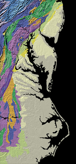
The Atlantic Seaboard Fall Line, or Fall Zone, is a 900-mile (1,400 km) escarpment where the Piedmont and Atlantic coastal plain meet in the eastern United States.[2] Much of the Atlantic Seaboard fall line passes through areas where no evidence of faulting is present.

Atlantic Seaboard fall line

United States

900 mi (1,400 km)[2]

The fall line marks the geologic boundary of hard metamorphosed terrain—the product of the Taconic orogeny—and the sandy, relatively flat alluvial plain of the upper continental shelf, formed of unconsolidated Cretaceous and Cenozoic sediments. Examples of Fall Zone features include the Potomac River's Little Falls and the rapids in Richmond, Virginia, where the James River falls across a series of rapids down to its own tidal estuary.


Before navigation improvements such as locks, the fall line was generally the head of navigation on rivers due to their rapids or waterfalls, and the necessary portage around them. Numerous cities initially formed along the fall line because of the easy river transportation to seaports, as well the availability of water power to operate mills and factories, thus bringing together river traffic and industrial labor. U.S. Route 1 and I-95 link many of the fall-line cities.


In 1808, Treasury Secretary Albert Gallatin noted the significance of the fall line as an obstacle to improved national communication and commerce between the Atlantic seaboard and the western river systems:[3]

on the Raritan River

New Brunswick, New Jersey

on the Millstone River

Princeton, New Jersey

on the Delaware River.[2]

Trenton, New Jersey

on the Schuylkill River.[4]

Philadelphia, Pennsylvania

on the Brandywine River.

Wilmington, Delaware

and Havre de Grace, Maryland, on the Susquehanna River/head of Chesapeake Bay.

Perryville, Maryland

on Herring Run, Jones Falls, and Gwynns Falls.[5]

Baltimore, Maryland

on the Patapsco River.

Elkridge, Maryland

on the Patuxent River.

Laurel, Maryland

on the Potomac River.[6]

Washington, D.C.

on the Occoquan River.

Occoquan, Virginia

on the Rappahannock River.[6]

Fredericksburg, Virginia

on the James River.[7]

Richmond, Virginia

on the Appomattox River.[8]

Petersburg, Virginia

and Roanoke Rapids, North Carolina, on the Roanoke River[9]

Weldon, North Carolina

on the Tar River.[9]

Rocky Mount, North Carolina

Kinston, Smithfield, and Goldsboro, North Carolina, on the .[9]

Neuse River

on the Cape Fear River.[9]

Fayetteville, North Carolina

on the Lumber River.[9]

Lumberton, North Carolina

on the Pee Dee River.

Cheraw, South Carolina

on the Wateree River.

Camden, South Carolina

on the Congaree River.[7]

Columbia, South Carolina

on the Savannah River.[10]

Augusta, Georgia

on the Oconee River.[10]

Milledgeville, Georgia

on the Ocmulgee River.[10]

Macon, Georgia

on the Chattahoochee River.[2]

Columbus, Georgia

on the Tallapoosa River[11]

Tallassee, Alabama

on the Coosa River[11]

Wetumpka, Alabama

on the Black Warrior River[11]

Tuscaloosa, Alabama

Some cities that lie along the Piedmont–Coastal Plain fall line include the following (from north to south):