Cape Elizabeth, Maine
Cape Elizabeth is a town in Cumberland County, Maine, United States. The town is part of the Portland–South Portland–Biddeford, Maine, metropolitan statistical area. As of the 2020 census, Cape Elizabeth had a population of 9,535.[2]
"Cape Elizabeth" redirects here. For the cape in Russia, see Cape Elizabeth (Sakhalin).
Cape Elizabeth
United States
November 1, 1765
Cape Elizabeth
Cape Cottage
Delano Park
Elizabeth Park
Mountainview Park
Pond Cove
Two Lights
Kettle Cove
Spurwink Shores
Oakhurst
Shore Acres
Bowery Beach
Casino Beach
Oceanhouse Heights
Fowler
Broad Cove
Great Pond
45.93 sq mi (118.96 km2)
14.70 sq mi (38.07 km2)
31.23 sq mi (80.89 km2)
62 ft (19 m)
9,535
649/sq mi (250.5/km2)
UTC−4 (EDT)
23-10180
0582387
Cape Elizabeth is the location of the Beach to Beacon 10K road race that starts at Crescent Beach State Park (the "beach") and ends at Portland Head Light (the "beacon"). The race draws runners from all parts of the U.S. and elite athletes from around the world.
Cape Elizabeth has a single community school department. The Cape Elizabeth High School's team name is the "Capers".
First explorations by the Kingdom of Spain set a map with the location of Cape Elizabeth, naming it "Cabo de Arrecife" in 1525.
English explorer Bartholomew Gosnold arrived at Cape Elizabeth in May 1602, during his explorations of what would later be called New England. At the southern tip of the promontory, Richmond Island was visited around 1605 by Samuel de Champlain and was the site of a trading post in 1628. John Smith explored and mapped New England in 1615, and gave names to places mainly based on the names used by Native Americans. When Smith presented his map to King Charles I, he suggested that the king should feel free to change any of the Indian names to English ones. The king made many such changes, but only four survive today, one of which is Cape Elizabeth, which Charles named in honor of his sister, Elizabeth of Bohemia.[3]
The first habitation by Europeans was on Richmond Island. Without title, Walter Bagnall (called "Great Walt") in 1628 established a trading post, dealing in rum and beaver skins. "His principal purpose appears to have been to drive a profitable trade with the Indians," writes historian George J. Varney, "without scruple about his methods." His cheating caught up with him in October 1631, when he was killed by the Indians, who also burned down his trading post.[4]
Two months later, the Plymouth Company granted Richmond Island to Robert Trelawney and Moses Goodyear, merchants of Plymouth, England, who made it a center for fisheries and trade. By 1638, Trelawney employed 60 men in the fisheries. The first settlers on the mainland were George Cleeve and Richard Tucker, who settled in 1630 on the shore opposite the island, near the Spurwink River. They worked at planting, fishing and trading. Two years later they were driven off by John Winter, Trelawny's agent. In 1636, Sir Ferdinando Gorges, lord proprietor of Maine, gave Cleeve and Tucker a grant of 1,500 acres (6.1 km2) including the neck of land called Machegonne—now Portland. In 1643 English Parliamentarian Alexander Rigby bought the large existing Plough of Lygonia patent, which included Cape Elizabeth.[5]
The Cape Elizabeth settlement on the Fore River was known as Purpoodock. It was attacked during King Philip's War in 1675. During King William's War, in Major Benjamin Church's second expedition a year later on 11 September 1690, he arrived with 300 men at Casco Bay. He went up the Androscoggin River to Fort Pejepscot (present-day Brunswick, Maine).[6] From there he went 40 miles (64 km) upriver and attacked a native village. Three or four native men were shot while retreating; Church discovered five captive New Englanders in the wigwams; six or seven prisoners were summarily killed as an example;[7] and nine prisoners were taken. A few days later, in retaliation, the natives attacked Church at Cape Elizabeth on Purpooduc Point, killing seven of his men and wounding 24 others.[8] On September 26, Church returned to Portsmouth, New Hampshire.
In 1703, during Queen Anne's War, the town was destroyed. It was resettled about 1719 or 1720.
Cape Elizabeth became Maine's 23rd town on November 1, 1765, when it separated from Falmouth, as Portland was then known. Its first town meeting was held on December 2, 1765.[5] South Portland separated in 1895 from Cape Elizabeth, which contains a number of houses designed by John Calvin Stevens.
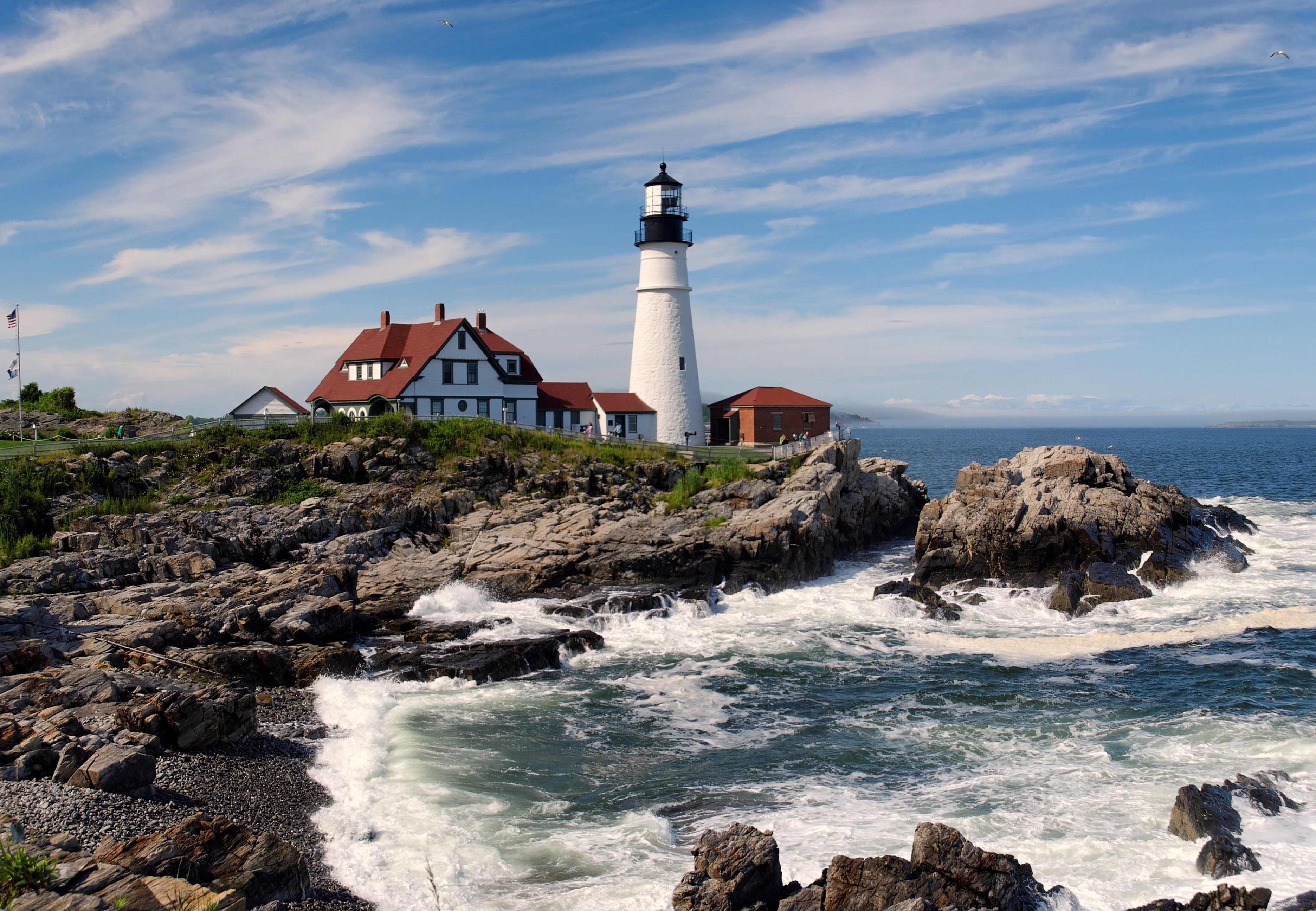
In 1872, construction of a US Army coast artillery fort began around Portland Head Light, which in 1899 was named Fort Williams, after Major General Seth Williams of the Civil War. The fort was to guard the southern entrance to Portland Harbor. Active between 1899 and 1962, the fort was then purchased by the town for about $200,000. Today, Fort Williams Park includes Portland Head Light and museum, some remains of the military fort, the ruins of Goddard Mansion, tennis courts, a baseball diamond and grandstand, and other recreation facilities. The park is maintained by the town and has a pay display parking system to assist with park repairs.[9]


