Katana VentraIP

Early world maps

The earliest known world maps date to classical antiquity, the oldest examples of the 6th to 5th centuries BCE still based on the flat Earth paradigm. World maps assuming a spherical Earth first appear in the Hellenistic period. The developments of Greek geography during this time, notably by Eratosthenes and Posidonius culminated in the Roman era, with Ptolemy's world map (2nd century CE), which would remain authoritative throughout the Middle Ages. Since Ptolemy, knowledge of the approximate size of the Earth allowed cartographers to estimate the extent of their geographical knowledge, and to indicate parts of the planet known to exist but not yet explored as terra incognita.

Further information: List of historical maps and history of cartography

With the Age of Discovery, during the 15th to 18th centuries, world maps became increasingly accurate; exploration of Antarctica, Australia, and the interior of Africa by western mapmakers was left to the 19th and early 20th century.

Antiquity[edit]

Bronze Age Saint-Bélec slab[edit]

The Saint-Bélec slab discovered in 1900 by Paul du Châtellier, in Finistère, France, is dated to between 1900 BCE and 1640 BCE. A recent analysis, published in the Bulletin of the French Prehistoric Society, has shown that the slab is a three-dimensional representation of the River Odet valley in Finistère, France. This would make the Saint-Bélec slab the oldest known map of a territory in the world. According to the authors, the map probably was not used for navigation, but rather to show the political power and territorial extent of a local ruler’s domain of the early Bronze age.[1][2][3][4]

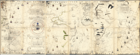
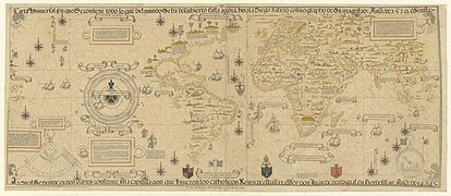
1525 Castiglione Map

1525 Castiglione Map

1527 Weimar Map

1527 Weimar Map

1529 Propaganda Map

1529 Propaganda Map

Brodersen, Kai (2012). "Chapter 4: Cartography". . By Dueck, Daniela. Cambridge: Cambridge Univ. Press. pp. 99–110. ISBN 9780521197885.

Geography in Classical Antiquity

Edson, Evelyn (1993). "The Oldest World Maps: Classical Sources of Three Eighth Century Mappaemundi". Ancient World. 24 (2): 169–184.

Fox, Michael; Reimer, Stephen R (2008). Mappae Mundi: Representing the World and Its Inhabitants In Texts, Maps, and Images In Medieval and Early Modern Europe. Edmonton: Department of English and Film Studies, University of Alberta.  9781551951874. OCLC 227019112.

ISBN

Goffart, Walter (2003). Historical Atlases: The First Three Hundred Years, 1570–1870. Chicago: Univ. of Chicago Press.  9780226300726. OCLC 727367115.

ISBN

Harwood, Jeremy; Bendall, A. Sarah (2006). To the Ends of the Earth: 100 Maps That Changed the World. Cincinnati, OH: David & Charles.  9781582974644. OCLC 75546416.

ISBN

Harvey, Paul D.A., ed. (2006). The Hereford World Map: Medieval World Maps and their Context. London: British Library.  9780712347600. OCLC 0712347607.

ISBN

Shirley, Rodney W. (1993). The Mapping of the World: Early Printed World Maps 1472–1700. London: Holland Press.  9781853682711. OCLC 29389647.

ISBN

Talbert, Richard J.A., ed. (2000). Barrington Atlas of the Greek and Roman World. Princeton, NJ: Princeton Univ. Press.  9780691031699. OCLC 43970336.

ISBN

Wendt, Henry; Delaney, John; Bowles, Alex (2010). Envisioning the World: The First Printed Maps 1472–1700. Santa Rosa, CA: Sonoma County Museum.  617728973.

OCLC

Woodward, David (1985). "Reality, Symbolism, Time, and Space in Medieval World Maps". Annals of the Association of American Geographers. 75 (4): 510–521. :10.1111/j.1467-8306.1985.tb00090.x.

doi

Archived 2007-03-12 at the Wayback Machine

Index of Maps of the Early Medieval Period – HenryDavis.com

– resource from the British Library

Mapping History

Geography and Map Reading Room at the Library of Congress

Ancient World Maps

The Peutinger Map

: Digital Editions of Early Medieval Maps of the World, edit. Martin Foys, Heather Wacha, et al. (Philadelphia, PA: Schoenberg Institute of Manuscript Studies, 2018): doi:10.21231/ef21-ev82

Virtual Mappa

Medieval Maps and Mapping Resources

Media related to Maps of the world before Columbus at Wikimedia Commons