Katana VentraIP

GNSS augmentation

Augmentation of a global navigation satellite system (GNSS) is a method of improving the navigation system's attributes, such as precision, reliability, and availability, through the integration of external information into the calculation process. There are many such systems in place, and they are generally named or described based on how the GNSS sensor receives the external information. Some systems transmit additional information about sources of error (such as clock drift, ephemeris, or ionospheric delay), others provide direct measurements of how much the signal was off in the past, while a third group provides additional vehicle information to be integrated in the calculation process.

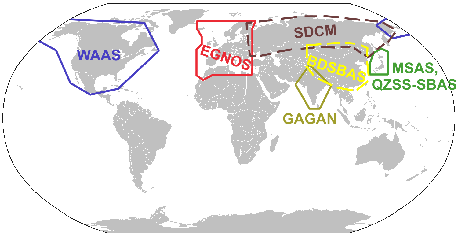
The (WAAS), operated by the United States Federal Aviation Administration (FAA).

Wide Area Augmentation System

The (EGNOS), operated by the ESSP (on behalf of EU's GSA).

European Geostationary Navigation Overlay Service

The (MSAS), operated by Japan's Ministry of Land, Infrastructure and Transport Japan Civil Aviation Bureau (JCAB).

Multi-functional Satellite Augmentation System

The (QZSS), operated by Japan, started initial operations in November 2018. QZSS also operates in a non-SBAS mode called PNT, essentially acting as extra GNSS satellites.

Quasi-Zenith Satellite System

The (GAGAN), operated by the Airports Authority of India.[2][3]

GPS-Aided GEO Augmented Navigation

The (SDCM), operated by Russia's Roscosmos based on GLONASS.

System for Differential Corrections and Monitoring

The (BDSBAS), proposed by China based on BeiDou.[4]

BeiDou Satellite-Based Augmentation System

The (SouthPAN), being developed by Australia and New Zealand with initial services expected in 2022.[5]

Southern Positioning Augmentation Network

The (WAGE), operated by the United States Department of Defense for use by military and authorized receivers.

Wide Area GPS Enhancement

The commercial , operated by John Deere and C-Nav Positioning Solutions (Oceaneering).

StarFire navigation system

The commercial and OmniSTAR system, operated by Fugro.

Starfix DGPS System

The commercial system, operated by Hemisphere GNSS.

Atlas GNSS Global L-Band Correction Service

The , short for GPS Correction, was a differential GPS data source for most of Canada, maintained by the Canadian Active Control System, part of Natural Resources Canada – now decommissioned.

GPS·C

The Australian SBAS using the Inmarsat 4F1 geostationary satellite, which suffered an outage in April 2023.[7]

[6]

Satellite-based augmentation systems (SBAS) support wide-area or regional augmentation through the use of additional satellite-broadcast messages. Using measurements from the ground stations, correction messages are created and sent to one or more satellites for broadcast to end users as differential signal. SBAS is sometimes synonymous with WADGPS, wide-area differential GPS.[1]


The SBAS that have been implemented or proposed include:

receivers

eLORAN

Automated systems

celestial navigation

Inertial navigation systems

often multiple systems are used to create a positional fix (DME/DME). Can also be used with INS (DME/DME/INS).

Distance measuring equipment

Simple systems (composed of a gyro compass and a distance measurement)

dead reckoning

The augmentation may also take the form of additional information from navigation sensors being blended into the position calculation, or internal algorithms that improve the navigation performance. Many times the additional avionics operate via separate principles from the GNSS and are not necessarily subject to the same sources of error or interference. A system such as this is referred to as an aircraft-based augmentation system (ABAS) by the ICAO. The most widely used form of ABAS is receiver autonomous integrity monitoring (RAIM), which uses redundant GPS signals to ensure the integrity of the position solution, and to detect faulty signals.[11]


Additional sensors may include:

(A-GPS)

Assisted GPS

GNSS enhancement

Satellite navigation