Geography of New Zealand
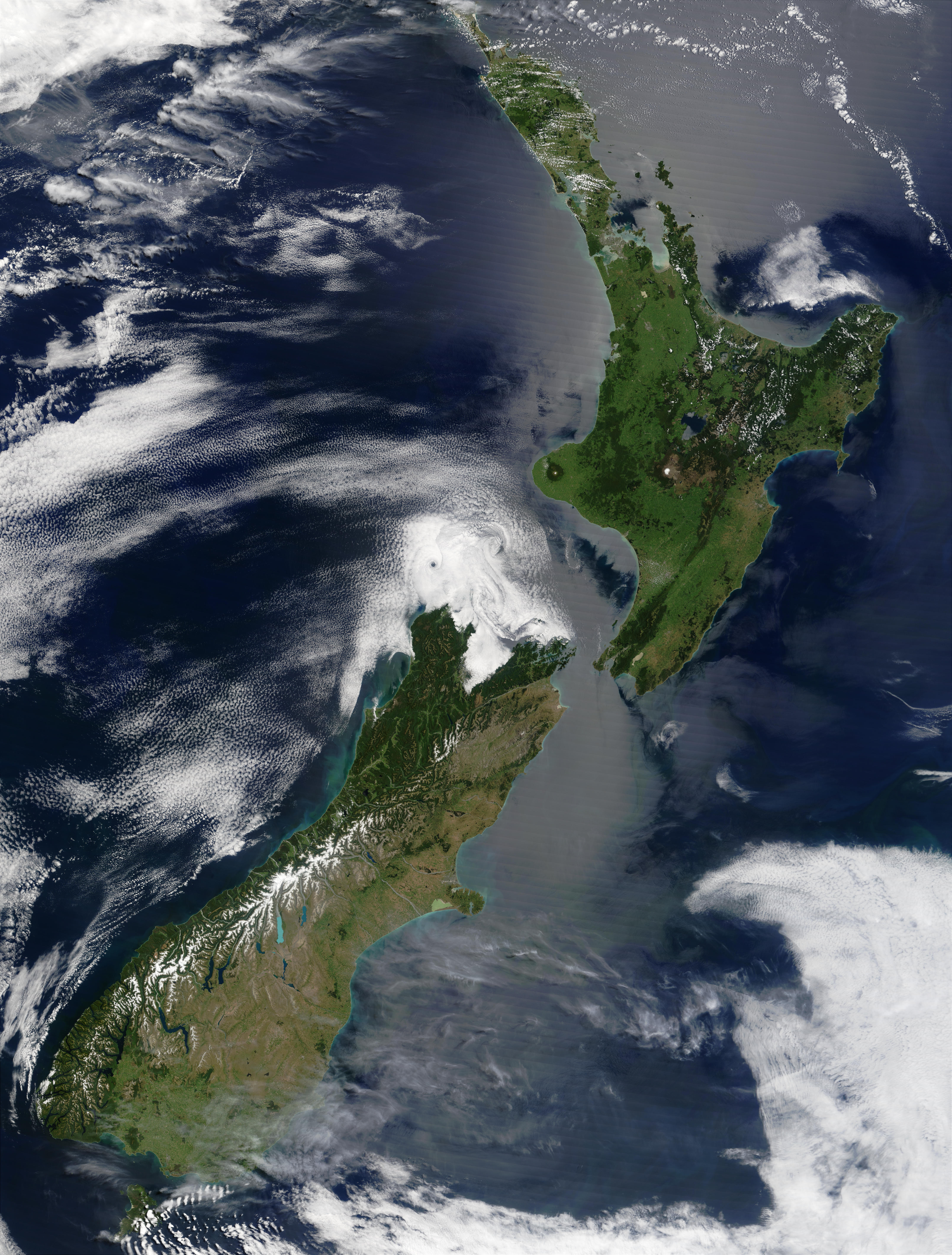
New Zealand (Māori: Aotearoa) is an island country located in the southwestern Pacific Ocean, near the centre of the water hemisphere. It consists of a large number of islands, estimated around 700, mainly remnants of a larger landmass now beneath the sea. The land masses by size are the South Island (or Te Waipounamu) and the North Island (or Te Ika-a-Māui), separated by the Cook Strait. The third-largest is Stewart Island / Rakiura, located 30 kilometres (19 miles) off the tip of the South Island across Foveaux Strait. Other islands are significantly smaller in area. The three largest islands stretch 1,600 kilometres (990 miles) across latitudes 35° to 47° south.[2] New Zealand is the sixth-largest island country in the world, with a land size of 268,680 km2 (103,740 sq mi).[3]
Region
268,680 km2 (103,740 sq mi)
97.9%
2.1%
15,134 km (9,404 mi)
0 km
Aoraki / Mount Cook
3,724 m (12,218 ft)
Taieri Plain
−2 m
Waikato River
425 km (264 mi)
Lake Taupō
3,487 km2 (1,346 sq mi)
Mostly temperate, with some areas being tundra and subantarctic
Mostly mountainous or steep hills, volcanic peaks in the central North Island, and fiords in the far south west.
Natural gas, iron ore, sand, coal, timber, hydropower, gold, limestone[1]
Flooding, earthquakes, volcanic activity, tsunamis
4,083,744 km2 (1,576,742 sq mi)
New Zealand's landscapes range from the fiord-like sounds of the southwest to the sandy beaches of the subtropical Far North. The South Island is dominated by the Southern Alps while a volcanic plateau covers much of the central North Island. Temperatures commonly fall below 0 °C (32 °F) and rise above 30 °C (86 °F) then conditions vary from wet and cold on the South Island's west coast to dry and continental a short distance away across the mountains and to the tundra like climate in the Deep South of Southland.
About two-thirds of the land is economically useful, with the remainder being mountainous. The North Island is the most populous island with 4 million residents, and Auckland being by far the largest metropolitan area in the country by population and urban area. The South Island is the second-most populated island, with over 1.18 million people, but is geographically larger than the North.
New Zealand is situated on the boundary of the Pacific and Australian tectonic plates, making it one of the most active earthquake and volcanic regions in the world. The country has experienced several devastating earthquakes throughout its history.
The New Zealand mainland is about 2,000 kilometres (1,200 miles) east of the Australian mainland across the Tasman Sea, the closest foreign neighbour to its main islands being Norfolk Island (Australia) about 750 kilometres (470 miles) to the north west. Other island groups to the north are New Caledonia, Tonga and Fiji. It is the southernmost nation in Oceania. The relative close proximity of New Zealand to Antarctica has made the South Island a major gateway for scientific expeditions to the continent.
Natural hazards[edit]
Flooding is the most regular natural hazard.[90] New Zealand is swept by weather systems that bring heavy rain; settlements are usually close to hill-country areas which experience much higher rainfall than the lowlands due to the orographic effect. Mountain streams which feed the major rivers rise rapidly and frequently break their banks covering farms with water and silt.[91] Close monitoring, weather forecasting, stopbanks, dams, and reafforestation programmes in hill country have ameliorated the worst effects.[92]
New Zealand experiences around 14,000 earthquakes a year,[93] some in excess of magnitude 7 (M7). Since the 2010, several large (M7, M6.3, M6.4, M6.2) and shallow (all <7 km) earthquakes have occurred immediately beneath Christchurch.[94] These have resulted in 185 deaths, widespread destruction of buildings and significant liquefaction.[95] These earthquakes are releasing distributed stress in the Pacific plate from the ongoing collision with the Indo-Australian plate to the west and north of the city. Volcanic activity is most common on the central North Island Volcanic Plateau. Tsunamis affecting New Zealand are associated with the Pacific Ring of Fire.[96]
Droughts are not regular and occur mainly in Otago and the Canterbury Plains and less frequently over much of the North Island between January and April. Forest fires were rare in New Zealand before the arrival of humans.[97] During a designated summer season, lighting a fire in the open is banned on public conservation land.[98]
Popular culture[edit]
New Zealand's varied landscape has appeared in television shows, such as Hercules: The Legendary Journeys and Xena: Warrior Princess. An increasing number of feature films have been shot on location in New Zealand for its scenery, including the Lord of the Rings trilogy.[119]
New Zealand is often mistakenly omitted from world maps due to the country's physical geographic isolation, relatively small size (compared to Australia), and its positioning on the extreme bottom-right in many map projections such as the Mercator.[120][121] The phenomenon has been popularly referenced and has a dedicated Reddit community.[122][121]
![]() This article incorporates public domain material from The World Factbook. CIA.
This article incorporates public domain material from The World Factbook. CIA.