Haleakalā
Haleakalā (/ˌhɑːliˌɑːkəˈlɑː/; Hawaiian: Hawaiian pronunciation: [ˈhɐlɛˈjɐkəˈlaː]), or the East Maui Volcano, is a massive, active shield volcano that forms more than 75% of the Hawaiian Island of Maui. The western 25% of the island is formed by another volcano, Mauna Kahalawai, also referred to as the West Maui Mountains.
For the historic house, see Haleʻākala.Haleakalā
10,023 ft (3,055 m)
10,023 ft (3,055 m)
123 kilometers (76 mi)
USGS Kilohana (HI)
<1.0 Ma, Pleistocene epoch
between 1480 and 1600[1]
paved highway
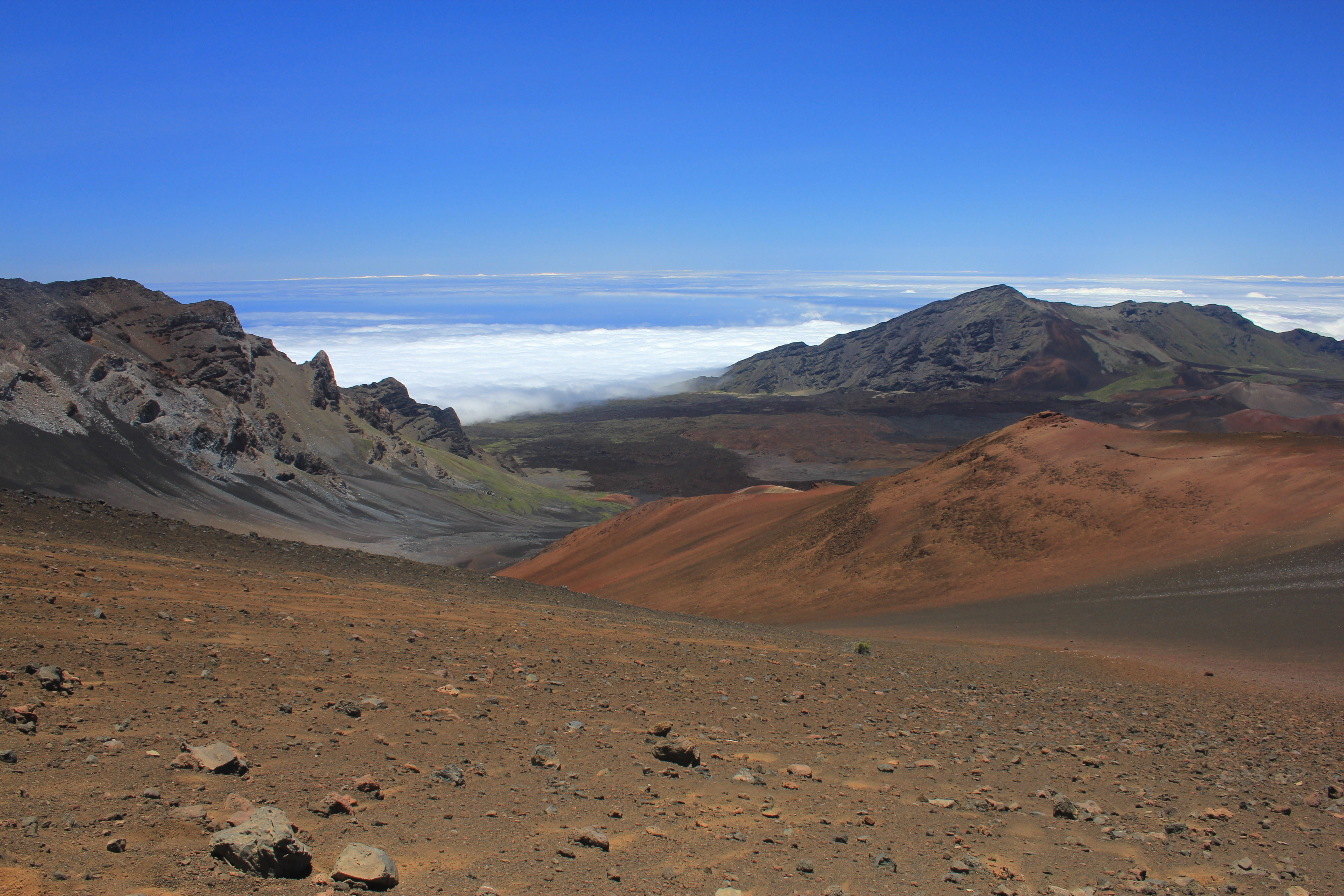
The tallest peak of Haleakalā ("house of the sun"), at 10,023 feet (3,055 m), is Puʻu ʻUlaʻula (Red Hill). From the summit one looks down into a massive depression some 11.25 km (6.99 mi) across, 3.2 km (2.0 mi) wide, and nearly 800 m (2,600 ft) deep. The surrounding walls are steep and the interior mostly barren-looking with a scattering of volcanic cones.
History[edit]
Early Hawaiians applied the name Haleakalā ("house of the sun") to the general mountain. Haleakalā is also the name of a peak on the southwestern edge of Kaupō Gap. In Hawaiian folklore, the depression (crater) at the summit of Haleakalā was home to the grandmother of the demigod Māui. According to the legend, Māui's grandmother helped him capture the sun and force it to slow its journey across the sky in order to lengthen the day.
Endangered species[edit]
Nēnē[edit]
The nēnē bird is on the endangered species list. The bird was once on all the islands of Hawaii but now it is only on the Island of Hawaii, Maui, and Kauai. Habitat loss, hunting, and introduction of mammals caused the bird population to dwindle.[11] Since 2010, only 2,000 birds were left. These birds were then kept in captivity to increase the population.
Modern uses[edit]
National Park[edit]
Surrounding and including the crater is Haleakalā National Park, a 30,183-acre (122.15 km2) park, of which 24,719 acres (100.03 km2) are wilderness.[17] The park includes the summit depression, Kipahulu Valley on the southeast, and ʻOheʻo Gulch (and pools), extending to the shoreline in the Kipahulu area. From the summit, there are two main trails leading into Haleakalā: Sliding Sands Trail and Halemauʻu Trail.
The temperature near the summit tends to vary between about 40 and 60 °F (4 and 16 °C) and, especially given the thin air and the possibility of dehydration at that elevation, the walking trails can be more challenging than one might expect. This is aggravated by the fact that trails lead downhill from parking areas into the crater. Because of this, hikers are faced with a difficult return ascent after potentially descending 2000 ft or more to the crater floor. Despite this, Haleakalā is popular with tourists and locals alike, who often venture to its summit, or to the visitor center just below the summit, to view the sunrise. There is lodging in the form of a few simple cabins, though no food or gas is available in the park.[18]
To help with preservation efforts, Haleakala National Park started requiring a sunrise reservation to enter Haleakala National Park between the hours of 3:00 AM and 7:00 AM HST.[19]