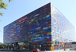
Hilversum
Hilversum (Dutch pronunciation: [ˈɦɪlvərsʏm] ⓘ) is a city and municipality in the province of North Holland, Netherlands. Located in the heart of the Gooi, it is the largest urban centre in that area. It is surrounded by heathland, woods, meadows, lakes and smaller towns. Hilversum is part of the Randstad, one of the largest conurbations in Europe, and the Amsterdam metropolitan area; it is about 22 km southeast of Amsterdam's city centre and about 15 km north of Utrecht.
Hilversum
Gerhard van den Top (Non-partisan)
- Wimar Jaeger
- Floris Voorink
- Willem van der Spek
- Eric van der Want
46.35 km2 (17.90 sq mi)
45.61 km2 (17.61 sq mi)
0.74 km2 (0.29 sq mi)
15 m (49 ft)
90,261
2,000/km2 (5,000/sq mi)
Hilversummer (male), Hilversumse (female)
035
The city is home to the headquarters, studios and broadcast stations of several major radio, television and newspaper companies such as Nederlandse Omroep Stichting. Hilversum is thus known for being the mediastad (media city) of the Netherlands.
Town[edit]
Hilversum lies 24 km (15 mi) south-east of Amsterdam and 15 km (9.3 mi) north of Utrecht. The town is known for its architecturally important Town Hall (Raadhuis Hilversum), designed by Willem Marinus Dudok and built in 1931.
Hilversum has one public library, two swimming pools (Van Hellemond Sport and De Lieberg), a number of sports halls, and several shopping centers (such as Hilvertshof, Winkelcentrum Kerkelanden, De Riebeeckgalerij, and Winkelcentrum Seinhorst). Locally, the town center is known as het dorp, which means "the village".
Geography[edit]
Hilversum is located on the sandy, hilly parts of the Gooi, and has four hills: the closest to the centre of town in the Boomberg. Then the Trompenberg (now a luxury residential area where, among others, the Brenninkmeijer family live, of C&A fame), and to the south the Hoorneboeg (25 m) and two kilometres easterly of that the Zwaluwenberg, where since 1950 the headquarters of the inspector-general of the armies is located. These hills date from the period of the Ice-age, when gletschers pushed walls of earth before them. Hilversum was the farthest southern edge the glaciers reached.
Surrounding towns are Nieuw-Loosdrecht, Bussum, Kortenhoef, Blaricum, Hollandsche Rading, Lage Vuursche, Maartensdijk, 's-Graveland, Laren, Nederhorst den Berg and Ankeveen.
Hilversum consists of the following districts and neighborhoods: Center (Langgewenstbuurt, Sint Vitusbuurt, Havenstraatbuurt and Centrum), Northwest (Nimrodpark, Trompenberg North, Trompenberg South, Media Park, Raadhuiskwartier and Boomberg), Northeast (North, Johannes Geradtswegbuurt, Erfgooiersbuurt and AZC Crailo), East (Geuzenbuurt, Electrobuurt, Astronomiebuurt, Science neighborhood, Kamrad, Kleine Driftbuurt and Liebergen), Southeast (Bloemkwartier Noord, Bloemenkwartier Zuid, Painterskwartier, 't Hoogt van' t Kruis, Arenaparkkwartier and West Indiëkwartier), Zuid (Writerskwartier, Staatsliedenkwartier and Zeeheldenkwartier), Southwest ( Kerkelanden, Havenkwartier, Zeverijn and Het Rode Dorp) and Hilversumse Meent. In 1767 Hilversum was still divided into 4 districts (quarters): the Neuquartier, Groestquartier, Kerkquartier and the Sandtbergerquartier.
The Oude Haven in the southwest is at the end of the Gooische Vaart. The construction of the canal between 's-Graveland and Hilversum was done in stages over 240 years. The canal was completed in 1876. Later, a modern harbor was dug, surrounded by an industrial estate. There is also a leisure harbor.


