
Little Cottonwood Canyon
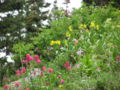
Little Cottonwood Canyon lies within the Wasatch-Cache National Forest along the eastern side of the Salt Lake Valley, roughly 15 miles from Salt Lake City, Utah. The canyon is part of Granite, a CDP and "Community Council" designated by Salt Lake County. The canyon is a glacial trough (U-shaped canyon), carved by an alpine glacier during the last ice age, 15,000 to 25,000 years ago. A number of rare and endemic plant species are found in the canyon's Albion Basin. Introduced Mountain goats inhabit the surrounding mountains.[1]
Little Cottonwood Canyon
5,400 ft (1,646 m)
Wasatch Mountain Range
The Salt Lake Temple of the Church of Jesus Christ of Latter-day Saints was built of blocks of quartz monzonite, granite, and granodiorite which Latter Day Saint pioneers quarried from the Little Cottonwood Stock near the mouth of the canyon.[2][3]
State Route 210 is the primary access road to the canyon, running from the canyon mouth up to Alta. Little Cottonwood Creek runs down the length of the canyon, beginning at Cecret Lake at Alta and flowing westward.
Geology[edit]
The Little Cottonwood stock is a granitic intrusion that extends from the mouth of the canyon almost to Snowbird ski resort. It is Oligocene in age, roughly 30.5 to 29 million years old, composed primarily of granodiorite, quartz monzonite, and granite, with some mafic enclaves. The Little Cottonwood stock is intruded in its northeast corner by another unit called the White Pine intrusion, and other smaller igneous units, collectively about 27-26 million years old, which are the source of the inactive White Pine molybdenum ore deposit in White Pine fork.[4]
The intrusion and its associated ore deposit have several interesting features, including quartz-bearing porphyry, pebble dikes, and other features related to hydrothermal ore deposit processes, and possibly volcanism, that occurred during intrusion.[4]
The intrusion is also the footwall of the East Traverse Mountain Mega-Landslide, and its presence is probably a second-order control on the cause of the landslide, in addition to the elevation gradient caused by the nearby Wasatch Fault.[4]
Hydrology[edit]
The Little Cottonwood Canyon watershed provides drinking water to much of Salt Lake County.[5] The National Forest Service considers Little Cottonwood Canyon a protected watershed area. In order to prevent contamination of the watershed by fecal runoff, no dogs (except service animals and avalanche search dogs) are permitted in the canyon.[6]
Gondola Controversy[edit]
On August 31, 2022, the Utah Department of Transportation (UDOT) announced "Gondola Alternative B", a plan to build a Gondola transit system connecting the base of Little Cottonwood Canyon with Alta and Snowbird ski areas. [14] A coalition of environmental groups opposed to the gondola have filed lawsuits against UDOT to block the gondola, claiming UDOT exceeded its authority and violated the National Environmental Policy Act .[15]
Fall Foliage in the canyon (September 2005)


U-shaped valley carved by a glacier in Little Cottonwood Canyon (July 2008)
