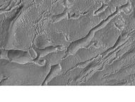
Mars Global Surveyor
Mars Global Surveyor (MGS) was an American robotic space probe developed by NASA's Jet Propulsion Laboratory and launched November 1996. MGS was a global mapping mission that examined the entire planet, from the ionosphere down through the atmosphere to the surface.[3] As part of the larger Mars Exploration Program, Mars Global Surveyor performed atmospheric monitoring for sister orbiters during aerobraking, and helped Mars rovers and lander missions by identifying potential landing sites and relaying surface telemetry.[3]
It completed its primary mission in January 2001 and was in its third extended mission phase when, on 2 November 2006, the spacecraft failed to respond to messages and commands. A faint signal was detected three days later which indicated that it had gone into safe mode. Attempts to recontact the spacecraft and resolve the problem failed, and NASA officially ended the mission in January 2007.[4] MGS remains in a stable near-polar circular orbit at about 450 km altitude and as of 1996, was expected to crash onto the surface of the planet in 2050.[5]
First complete test of aerobraking[edit]
The spacecraft was launched from a smaller Delta II rocket, necessitating restrictions in spacecraft weight. In order to achieve the near-circular orbit required for the mission while conserving propellant, the team designed a series of aerobraking maneuvers. Aerobraking had been successfully attempted by the Magellan mission at Venus, but the first complete test of the new procedure was to be carried out by MGS.[15]
Initially, MGS was placed in a highly elliptical orbit that took 45 hours to complete. The orbit had a periapsis of 262 km (163 mi) above the northern hemisphere, and an apoapsis of 54,026 km (33,570 mi) above the southern hemisphere. This would be subsequently be adjusted into its circular science orbit.[11]
After orbital insertion, MGS performed a series of orbit changes to lower the periapsis of its orbit into the upper fringes of the Martian atmosphere at an altitude of about 110 km (68 mi).[16] During every atmospheric pass, the spacecraft slowed down because of atmospheric resistance. This slowing caused the spacecraft to lose altitude on its next pass through the orbit's apoapsis. MGS had planned to use this aerobraking technique over a period of four months to lower the high point of its orbit from 54,000 km (33,554 mi) to altitudes near 450 km (280 mi).
About one month into the mission, it was discovered that air pressure from the planet's atmosphere caused one of the spacecraft's two solar panels to bend backwards. The panel in question had incurred a small amount of damage shortly after launch, the extent of which did not become apparent until subjected to atmospheric forces. MGS had to be raised out of the atmosphere to prevent further damage to the solar panel and a new mission plan had to be developed.[11]
From May to November 1998, aerobraking was temporarily suspended to allow the orbit to drift into the proper position with respect to the Sun and enable optimal use of the solar panels. Although data collection during aerobraking was not in the original mission plan, all science instruments remained functional and acquired vast amounts of data during this "unexpected bonus period of observation".[11] The team was able to evaluate more information about the atmosphere over a range of times rather than the anticipated fixed times of 0200 and 1400, as well as collect data during three close encounters with Phobos.[17]
Finally, from November 1998 to March 1999, aerobraking resumed and shrank the high point of the orbit down to 450 km (280 mi). At this altitude, MGS circled Mars once every two hours. Aerobraking was scheduled to terminate at the same time the orbit drifted into its proper position with respect to the Sun. In the desired orientation for mapping operations, the spacecraft always crossed the day-side equator at 14:00 (local Mars time) moving from south to north. This geometry was selected to enhance the total quality of the science return.[16]
Mission results[edit]
Mapping[edit]
The spacecraft circled Mars once every 117.65 minutes at an average altitude of 378 km (235 mi). The nearly polar orbit (inclination = 93°) which is almost perfectly circular, moved from the south pole to the north pole in just under an hour. The altitude was chosen to make the orbit Sun-synchronous, so that all images that were taken by the spacecraft of the same surface features on different dates were taken under identical lighting conditions. After each orbit, the spacecraft viewed the planet 28.62° to the west because Mars had rotated underneath it. In effect, it was always 14:00 for MGS as it moved from one time zone to the next exactly as fast as the Sun. After seven sols and 88 orbits, the spacecraft would approximately retrace its previous path, with an offset of 59 km to the east. This ensured eventual full coverage of the entire surface.[11]
In its extended mission, MGS did much more than study the planet directly beneath it. It commonly performed rolls and pitches to acquire images off its nadir track. The roll maneuvers, called ROTOs (Roll Only Targeting Opportunities), rolled the spacecraft left or right from its ground track to shoot images as much as 30° from nadir. It was possible for a pitch maneuver to be added to compensate for the relative motion between the spacecraft and the planet. This was called a CPROTO (Compensation Pitch Roll Targeting Opportunity), and allowed for some very high resolution imaging by the onboard MOC (Mars Orbiting Camera).[18]
In addition to this, MGS could shoot pictures of other orbiting bodies, such as other spacecraft and the moons of Mars. In 1998 it imaged what was later called the Phobos monolith, found in MOC Image 55103.[19]


