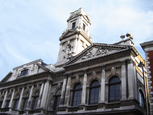
Shoreditch
Shoreditch is an area in London, England and is located in the London Borough of Hackney alongside neighbouring parts of Tower Hamlets, which are also perceived as part of the area due to historic ecclesiastical links. Shoreditch lies just north-east of the border with the City of London and is considered to be a part of London's East End.
Shoreditch
2.5 mi (4.0 km) WSW
United Kingdom
In the 16th century, Shoreditch was an important centre of the Elizabethan Theatre, and it has been an important entertainment centre since that time. Today, it hosts many pubs, bars and nightclubs.[1][2] The most commercial areas lie closest to the city of London and along the A10 Road, with the rest mostly residential.[3]
Toponymy[edit]
Early spellings of the name include Soredich (c. 1148), Soresdic (1183–4), Sordig (1204), Schoresdich (1220–21), and other variants.[4][5] Toponymists are generally agreed that the name derives from Old English "scoradīc", i.e. "shore-ditch", the shore being a riverbank or prominent slope;[6] but there is disagreement as to the identity of the "shore" in question. A suggestion made by Eilert Ekwall in 1936 that the "ditch" might have been one leading to the "shore" of the Thames continues to enjoy widespread currency.[7][8][9] Other scholars, however, have challenged this interpretation on the grounds that the City of London lies between Shoreditch and the Thames.[5][10] A variant spelling used by John Stow in 1598, Sewers Ditche, raises the possibility that the name might originally have referred to a drain or watercourse.[11][12] Certainly the area was once boggy, and the name might bear some relation to the main branch of the Walbrook, which rose in Hoxton, ran along what is now Curtain Road, flowing past the former Curtain Theatre. The river was known in this area as the Deepditch,[13] Flood Ditch or just The Ditch.
Folk etymology holds that the place was originally named "Shore's Ditch", after Jane Shore, the mistress of Edward IV, who is supposed to have died or been buried in a ditch in the area. This legend is commemorated today by a large painting, at Haggerston Branch Library, of the body of Shore being retrieved from the ditch, and by a design on glazed tiles in a shop in Shoreditch High Street showing her meeting Edward IV.[14] However, the area was known as Shoreditch long before Jane Shore lived: the Survey of London, for example, lists some 26 deeds dating from between c. 1148 and 1260 which use some version of the name.[4]
In another theory, also now discredited, antiquarian John Weever claimed that the name was derived from Sir John de Soerdich, who was lord of the manor during the reign of Edward III (1327–77).[15]
Transport[edit]
Rail[edit]
Shoreditch High Street station is near Boxpark, on Bethnal Green Road. The station is served by London Overground (![]() ) trains on the East London line, and is in London fare zone 1. Trains link the area directly to Dalston and Highbury & Islington to the northwest, whilst to the south, trains travel directly to major destinations like Canada Water, Clapham Junction, West Croydon, Crystal Palace, New Cross, Peckham and Whitechapel. Hoxton station is to the north of Shoreditch, on the same line.[60]
) trains on the East London line, and is in London fare zone 1. Trains link the area directly to Dalston and Highbury & Islington to the northwest, whilst to the south, trains travel directly to major destinations like Canada Water, Clapham Junction, West Croydon, Crystal Palace, New Cross, Peckham and Whitechapel. Hoxton station is to the north of Shoreditch, on the same line.[60]
There is a nearby Overground (![]() ) station at Bethnal Green, with services towards Hackney Downs, Seven Sisters, Chingford, Enfield, and Cheshunt.[60]
) station at Bethnal Green, with services towards Hackney Downs, Seven Sisters, Chingford, Enfield, and Cheshunt.[60]
Liverpool Street (![]()
![]()
![]()
![]() ) and Old Street (
) and Old Street (![]() ) tube stations are also nearby. Both stations are also on the National Rail network.
) tube stations are also nearby. Both stations are also on the National Rail network.
Until 2006, Shoreditch tube station was served by London Underground East London line trains. The line and station closed to make way for the London Overground.
Cycling[edit]
Two Transport for London (TfL) Cycleways pass through Shoreditch.
Cycle Superhighway 1 runs north-south along the western perimeter of the area, through the Old Street junction. The route is signposted, and links the area to Moorgate and Finsbury southbound, and to Dalston, Stoke Newington, and Seven Sisters to the north.
Quietway 13 runs east-west through Shoreditch, primarily on quiet streets. The route is signposted, and runs from Finsbury in the City to the Regent's Canal near Cambridge Heath.
The Regent's Canal towpath runs along the northernmost edge of the district, close to Shoreditch Park. The towpath is a shared-use path for pedestrians and cyclists and runs unbroken from Angel in Islington to Limehouse near Canary Wharf. Eastbound, the path links the area to Victoria Park and Mile End.[64][65]
The London Cycle Hire Scheme operates in Shoreditch.