Taurus–Littrow
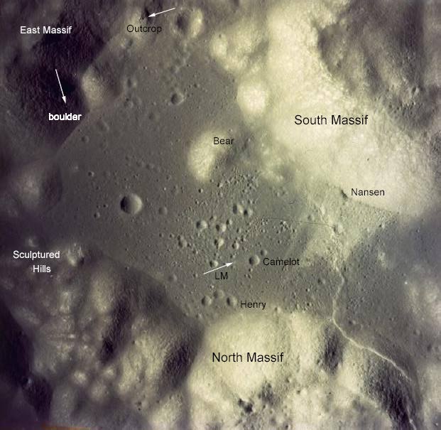
Taurus–Littrow is a lunar valley located on the near side at the coordinates 20°00′N 31°00′E / 20.0°N 31.0°E. It served as the landing site for the American Apollo 17 mission in December 1972, the last crewed mission to the Moon.[1][2] The valley is located on the southeastern edge of Mare Serenitatis along a ring of mountains formed between 3.8 and 3.9 billion years ago when a large object impacted the Moon, forming the Serenitatis basin and pushing rock outward and upward.[1]
Taurus–Littrow is located in the Taurus mountain range and south of Littrow crater, features from which the valley received its name. The valley's name, coined by the Apollo 17 crew, was approved by the International Astronomical Union in 1973.[1]
Data collected during Apollo 17 indicate that the valley is composed primarily of feldspar-rich breccia in the large massifs surrounding the valley and basalt underlying the valley floor, covered by an unconsolidated layer of mixed material formed by various geologic events.[3] Taurus–Littrow was selected as the Apollo 17 landing site with the objectives of sampling highland material and young volcanic material at the same location.[4]