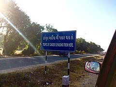
The Tropic of Cancer, also known as the Northern Tropic, is the Earth's northernmost circle of latitude where the Sun can be seen directly overhead. This occurs on the June solstice, when the Northern Hemisphere is tilted toward the Sun to its maximum extent.[1] It also reaches 90 degrees below the horizon at solar midnight on the December Solstice. Using a continuously updated formula, the circle is currently 23°26′10.0″ (or 23.43611°) north of the Equator.
Its Southern Hemisphere counterpart, marking the most southerly position at which the Sun can be seen directly overhead, is the Tropic of Capricorn. These tropics are two of the five major circles of latitude that mark maps of Earth, the others being the Arctic and Antarctic circles and the Equator. The positions of these two circles of latitude (relative to the Equator) are dictated by the tilt of Earth's axis of rotation relative to the plane of its orbit, and since the tilt changes, the location of these two circles also changes.
In geopolitics, it is known for being the southern limitation on the mutual defence obligation of NATO, as member states of NATO are not obligated to come to the defence of territory south of the Tropic of Cancer.[2]
Name[edit]
When this line of latitude was named in the last centuries BCE, the Sun was in the constellation Cancer (Latin: Crab) at the June solstice (90° ecliptic longitude). Due to the precession of the equinoxes, this is no longer the case; today the Sun is in constellation Taurus at the June solstice. The word "tropic" itself comes from the Greek "trope (τροπή)", meaning turn (change of direction or circumstance), inclination, referring to the fact that the Sun appears to "turn back" at the solstices.
Climate[edit]
The climate at the Tropic of Cancer is generally hot and dry, except for cooler highland regions in China, marine environments such as Hawaii, and easterly coastal areas, where orographic rainfall can be very heavy, in some places reaching 4 metres (160 in) annually. Most regions on the Tropic of Cancer experience two distinct seasons: an extremely hot summer with temperatures often reaching 45 °C (113 °F) and a warm winter with maxima around 22 °C (72 °F). Much land on or near the Tropic of Cancer is part of the Sahara Desert, while to the east, the climate is torrid monsoonal with a short wet season from June to September, and very little rainfall for the rest of the year.
The highest mountain on or adjacent to the Tropic of Cancer is Yu Shan in Taiwan. It had glaciers descending as low as 2,800 metres (9,190 ft) during the Last Glacial Maximum. At present glaciers still exist around[5] the Tropic. The nearest currently surviving are the Minyong and Baishui in the Himalayas to the north and on Iztaccíhuatl in Mexico to the south.


