
Victorian Downtown Los Angeles
The late-Victorian-era Downtown of Los Angeles in 1880 was centered at the southern end of the Los Angeles Plaza area, and over the next two decades, it extended south and west along Main Street, Spring Street, and Broadway towards Third Street. Most of the 19th-century buildings no longer exist, surviving only in the Plaza area or south of Second Street. The rest were demolished to make way for the Civic Center district with City Hall, numerous courthouses, and other municipal, county, state and federal buildings, and Times Mirror Square.[1][2] This article covers that area, between the Plaza, 3rd St., Los Angeles St., and Broadway, during the period 1880 through the period of demolition (1920s–1950s).
This article is about the area which formed the central business district during the 1880s and 1890s. For the neighborhoods famous for Victorian residences, see Angelino Heights, Los Angeles and Bunker Hill, Los Angeles.At the time (1880–1900s), the area was referred to as the business center, business section or business district. By 1910, it was referred to as the "North End" of the business district which by then had expanded south to what is today called the Historic Core, along Broadway, Spring and Main roughly from 3rd to 9th streets.[3]
The map shows the street grid in 1910, and shows in blue three important road alignment changes that came in the 1920s–1950s:
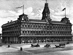
1905 view south on Broadway from north of Temple Street. The Times Mirror printing house in foreground, marked 110 N. Broadway, now site of the Hall of Justice. Towers of the 1888 City Hall on the 200 block of S. Broadway in the distance. Fort Moore Hill, now leveled, at right.
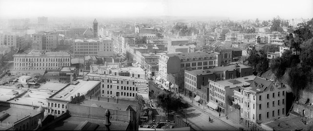
c.1893–1900, looking east along Third St. from Olive St. on Bunker Hill. 3 buildings stand out from left to right: the 1888 City Hall (Broadway between 2nd/3rd), the Stimson Block (3rd & Spring), and the Bradbury Building (3rd & Broadway)

The Women's Christian Temperance Union building, also known as Temperance Temple, at Temple and Fort (now Broadway) streets, with a Temple Street Cable Railway car, 1890

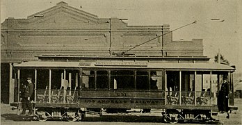
"Red car" of the Pacific Electric

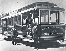
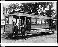
Main Street & Agricultural Park electric streetcar, c.1896
This is a map of the former and current buildings located in the Victorian business district of Los Angeles around 1890-1905.
Abbreviations and notes
To be read like a map: