Ho Chi Minh City
Ho Chi Minh City (HCMC, Vietnamese: Thành phố Hồ Chí Minh), commonly known as Saigon (Vietnamese: Sài Gòn), is the most populous city in Vietnam, with a population of around 9.3 million in 2023.[6] The city's geography is defined by rivers and canals, of which the eponymously-named Saigon River is the largest. As a municipality, Ho Chi Minh City consists of 16 urban districts, five rural districts, and one municipal city (sub-city). As the largest financial centre in Vietnam, Ho Chi Minh City has the highest gross regional domestic product out of all Vietnam provinces and municipalities,[7] contributing around a quarter of the country's total GDP.[8] Ho Chi Minh City's metropolitan area is ASEAN's 6th largest economy, also the biggest outside an ASEAN country capital.
"Saigon" and "HCMC" redirect here. For other uses, see Saigon (disambiguation) and HCMC (disambiguation).
Ho Chi Minh City
Thành phố Hồ Chí MinhSaigon (Sài Gòn)
Since the early times, water transport has been heavily used by inhabitants in the area. The area was occupied by Champa from 2nd century AD to around the 19th century, due to Đại Việt's expanist policy of Nam tiến. After the fall of Citadel of Gia Định, Saigon was the capital of French Indochina from 1887 to 1902, and again from 1945 until its cessation in 1954. Following the partition of French Indochina, it became the capital of South Vietnam until it was captured by North Vietnam, who renamed the city after their former leader Hồ Chí Minh, though the former name is still widely used in informal usages. Beginning in the 1990s, the city underwent rapid expansion and modernization, which contributed to Vietnam's post-war economic recovery and helped revive its international trade hub status.
Ho Chi Minh City has a long tradition of being a productive trading and manufacturing place in Vietnam. As such, the city is also the busiest international transport hub in Vietnam, as Tân Sơn Nhất International Airport accounts for nearly half of all international arrivals to Vietnam[9] and the Port of Saigon is among the busiest container ports in Southeast Asia.[10] Ho Chi Minh City is also a popular tourism destination. Some of the war and historic landmarks in the city include the Independence Palace, Landmark 81 (tallest building in Vietnam), the War Remnants Museum, and Bến Thành Market. The city is also known for its narrow walkable alleys and night life. Currently, Ho Chi Minh City is facing increasing threats of sea level rise and flooding as well as heavy strains on public infrastructures.
History[edit]
Early settlement[edit]
The earliest settlement in the area was a Funan temple at the location of the current Phụng Sơn Buddhist temple, founded in the 4th century AD.[22] A settlement called Baigaur was established on the site in the 11th century by the Champa.[22] Baigaur was renamed Prey Nokor after conquest by the Khmer Empire around 1145,[22] Prey Nokor grew on the site of a small fishing village and area of forest.[23]
The first Vietnamese people crossed the sea to explore this land completely without the organisation of the Nguyễn Lords. Thanks to the marriage between Princess Nguyễn Phúc Ngọc Vạn - daughter of Lord Nguyễn Phúc Nguyên - and the King of Cambodia Chey Chettha II in 1620, the relationship between Vietnam and Cambodia became smooth, and the people of the two countries could freely move back and forth. In exchange, Chey Chettha II gifted Prei Nokor to the Nguyễn lords.[24] Vietnamese settlers began to migrate to the area of Saigon, Đồng Nai. Before that, the Funanese, Khmer, and Cham had lived there, scattered from time immemorial.
The period from 1623 to 1698 is considered the period of the formation of later Saigon. In 1623, Lord Nguyen sent a mission to ask his son-in-law, King Chey Chettha II, to set up tax collection stations in Prey Nokor (Sài Gòn) and Kas Krobei (Bến Nghé). Although this was a deserted jungle area, it was located on the traffic routes between Vietnam, Cambodia, and Siam. The next two important events of this period were the establishment of the barracks and residence of Vice King Ang Non and the establishment of a palace at Tân Mỹ (near the present-day Cống Quỳnh–Nguyễn Trãi crossroads). It can be said that Saigon was formed from these three government agencies.
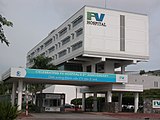
The health care system of the city is relatively developed with a chain of about 100 government owned hospitals or medical centres and dozens of international facilities,[125] as well as privately owned clinics.[62] The 1,400-bed Chợ Rẫy Hospital, upgraded by Japanese aid and the French-sponsored Institute of Cardiology, Prima Saigon Eye Hospital (Ophthalmology), a member of World Association of Eye Hospitals[126] and City International Hospital are among the top medical facilities in the South-East Asia region.
Education[edit]
High schools[edit]
Notable high schools in the city include Lê Hồng Phong High School for the Gifted, Phổ Thông Năng Khiếu High School for the Gifted, Trần Đại Nghĩa High School for the Gifted, Nguyễn Thượng Hiền High School, Nguyễn Thị Minh Khai High School, Gia Định High School, Lê Quý Đôn High School, Marie Curie High School, Võ Thị Sáu High School, Trần Phú High School and others. Though the former schools are all public, private education is also available in Ho Chi Minh City. High school consists of grade 10–12 (sophomore, junior, and senior).[127]


