Lake Baikal
Lake Baikal (/baɪˈkɑːl, -ˈkæl/ by-KAHL, -KAL;[3] Russian: Oзеро Байкал, romanized: Ozero Baykal [ˈozʲɪrə bɐjˈkaɫ]; Buryat: Байгал далай, romanized: Baigal dalai[4]) is a large rift lake in Russia. It is situated in southern Siberia, between the federal subjects of Irkutsk Oblast to the northwest and the Republic of Buryatia to the southeast.
"Baykal" redirects here. For other uses, see Baykal (disambiguation).Lake Baikal
Siberia, Russia
560,000 km2 (216,000 sq mi)
636 km (395 mi)
79 km (49 mi)
31,722 km2 (12,248 sq mi)[1]
744.4 m (2,442 ft; 407.0 fathoms)[1]
1,642 m (5,387 ft; 898 fathoms)[1]
23,610 km3 (5,660 cu mi)[1]
330 years[2]
2,100 km (1,300 mi)
455.5 m (1,494 ft)
January–May
27 (Olkhon Island)
Natural: vii, viii, ix, x
1996 (20th Session)
8,800,000 ha
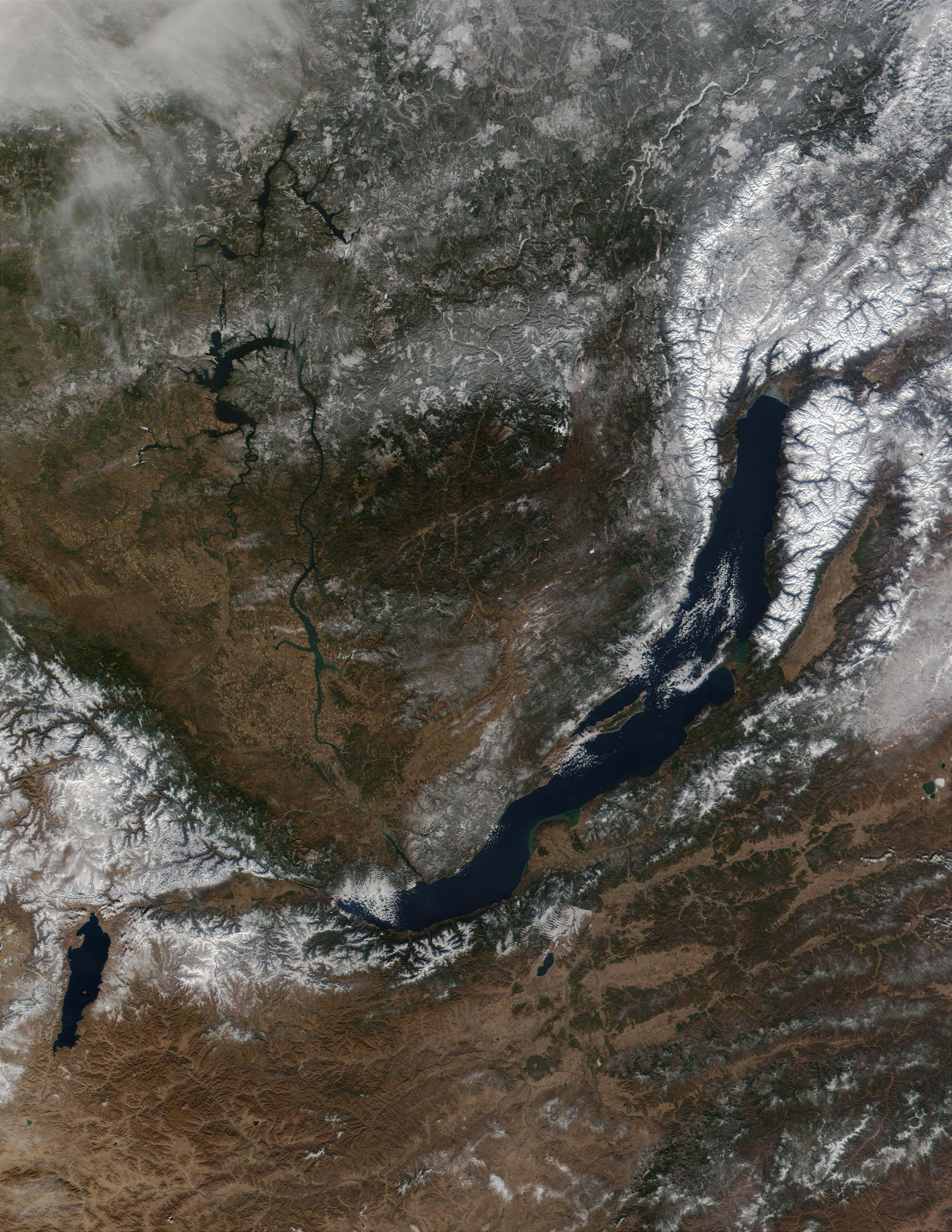
At 31,722 km2 (12,248 sq mi)—slightly larger than Belgium—Lake Baikal is the world's seventh-largest lake by surface area,[5] as well as the second largest lake in Eurasia after the Caspian Sea. However, because it is also the deepest lake,[6] with a maximum depth of 1,642 metres (5,387 feet; 898 fathoms),[1] Lake Baikal is the world's largest freshwater lake by volume, containing 23,615.39 km3 (5,670 cu mi) of water[1] or 22–23% of the world's fresh surface water,[7][8] more than all of the North American Great Lakes combined.[9] It is also the world's oldest lake[10] at 25–30 million years,[11][12] and among the clearest.[13]
Lake Baikal is home to thousands of species of plants and animals, many of them endemic to the region. It is also home to Buryat tribes, who raise goats, camels, cattle, sheep, and horses[14] on the eastern side of the lake,[15] where the mean temperature varies from a winter minimum of −19 °C (−2 °F) to a summer maximum of 14 °C (57 °F).[16] The region to the east of Lake Baikal is referred to as Transbaikalia or as the Transbaikal,[17] and the loosely defined region around the lake itself is sometimes known as Baikalia. UNESCO declared Baikal a World Heritage Site in 1996.[18]

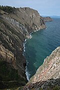
Cliffs on Olkhon Island


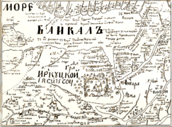
Russian map circa 1700, Baikal (not to scale) is at top
![Angara [ru] was launched in 1900 and is one of the oldest surviving icebreakers](http://upload.wikimedia.org/wikipedia/commons/thumb/a/a7/Ledokol_Angara.jpg/240px-Ledokol_Angara.jpg)
The Baikal area, sometimes known as Baikalia, has a long history of human habitation. Near the village of Mal'ta, some 160 km northwest of the lake, remains of a young human male known as MA-1 or "Mal'ta Boy" are indications of local habitation by the Mal'ta–Buret' culture ca. 24,000 BP. An early known tribe in the area was the Kurykans.[79]
Located in the former northern territory of the Xiongnu confederation, Lake Baikal is one site of the Han–Xiongnu War, where the armies of the Han dynasty pursued and defeated the Xiongnu forces from the second century BC to the first century AD. They recorded that the lake was a "huge sea" (hanhai) and designated it the North Sea (Běihǎi) of the semimythical Four Seas.[80] The Kurykans, a Siberian tribe who inhabited the area in the sixth century, gave it a name that translates to "much water". Later on, it was called "natural lake" (Baygal nuur) by the Buryats and "rich lake" (Bay göl) by the Yakuts.[81]
Little was known to Europeans about the lake until Russia expanded into the area in the 17th century. The first Russian explorer to reach Lake Baikal was Kurbat Ivanov in 1643.[82]
Lake Baikal was under the Anbei Protectorate of the Tang dynasty from 647 CE to 682 CE.
Russian expansion into the Buryat area around Lake Baikal[83] in 1628–58 was part of the Russian conquest of Siberia. It was done first by following the Angara River upstream from Yeniseysk (founded 1619) and later by moving south from the Lena River. Russians first heard of the Buryats in 1609 at Tomsk. According to folktales related a century after the fact, in 1623, Demid Pyanda, who may have been the first Russian to reach the Lena, crossed from the upper Lena to the Angara and arrived at Yeniseysk.[84]
Vikhor Savin (1624) and Maksim Perfilyev (1626 and 1627–28) explored Tungus country on the lower Angara. To the west, Krasnoyarsk on the upper Yenisei was founded in 1627. A number of ill-documented expeditions explored eastward from Krasnoyarsk. In 1628, Pyotr Beketov first encountered a group of Buryats and collected yasak (tribute) from them at the future site of Bratsk. In 1629, Yakov Khripunov set off from Tomsk to find a rumored silver mine. His men soon began plundering both Russians and natives. They were joined by another band of rioters from Krasnoyarsk, but left the Buryat country when they ran short of food. This made it difficult for other Russians to enter the area. In 1631, Maksim Perfilyev built an ostrog at Bratsk. The pacification was moderately successful, but in 1634, Bratsk was destroyed and its garrison killed. In 1635, Bratsk was restored by a punitive expedition under Radukovskii. In 1638, it was besieged unsuccessfully.
In 1638, Perfilyev crossed from the Angara over the Ilim portage to the Lena River and went downstream as far as Olyokminsk. Returning, he sailed up the Vitim River into the area east of Lake Baikal (1640) where he heard reports of the Amur country. In 1641, Verkholensk was founded on the upper Lena. In 1643, Kurbat Ivanov went further up the Lena and became the first Russian to see Lake Baikal and Olkhon Island. Half his party under Skorokhodov remained on the lake, reached the Upper Angara at its northern tip, and wintered on the Barguzin River on the northeast side.
In 1644, Ivan Pokhabov went up the Angara to Baikal, becoming perhaps the first Russian to use this route, which is difficult because of the rapids. He crossed the lake and explored the lower Selenge River. About 1647, he repeated the trip, obtained guides, and visited a 'Tsetsen Khan' near Ulan Bator. In 1648, Ivan Galkin built an ostrog on the Barguzin River which became a center for eastward expansion. In 1652, Vasily Kolesnikov reported from Barguzin that one could reach the Amur country by following the Selenga, Uda, and Khilok Rivers to the future sites of Chita and Nerchinsk.
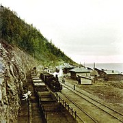
The Trans-Siberian Railway was built between 1896 and 1902. Construction of the scenic railway around the southwestern end of Lake Baikal required 200 bridges and 33 tunnels. Until its completion, a train ferry transported railcars across the lake from Port Baikal to Mysovaya for a number of years. The lake became the site of the minor engagement between the Czechoslovak legion and the Red Army in 1918. At times during winter freezes, the lake could be crossed on foot, though at risk of frostbite and deadly hypothermia from the cold wind moving unobstructed across flat expanses of ice. In the winter of 1920, the Great Siberian Ice March occurred, when the retreating White Russian Army crossed frozen Lake Baikal. The wind on the exposed lake was so cold, many people died, freezing in place until spring thaw. Beginning in 1956, the impounding of the Irkutsk Dam on the Angara River raised the level of the lake by 1.4 m (4.6 ft).[85]
As the railway was built, a large hydrogeographical expedition headed by F.K. Drizhenko produced the first detailed contour map of the lake bed.[10]
The first European to reach the lake is said to have been Kurbat Ivanov in 1643.[130]
In the past, the Baikal was referred to by many Russians as the "Baikal Sea" (море Байкал, More Baikal), rather than merely "Lake Baikal" (озеро Байкал, Ozero Baikal).[131]
This usage is attested already in the Life of Protopope Avvakum (1621–1682),[132] and on the late-17th-century maps by Semyon Remezov.[133] It is also attested in the famous song, now passed into the tradition, that opens with the words Славное море, священный Байкал (Glorious sea, [the] sacred Bajkal).
To this day, the strait between the western shore of the Lake and the Olkhon Island is called Maloye More (Малое море), i.e. "the Little Sea".
Lake Baikal is nicknamed "Older sister of Sister Lakes (Lake Khövsgöl and Lake Baikal)".[134]
According to 19th-century traveler T. W. Atkinson, locals in the Lake Baikal Region had the tradition that Christ visited the area:
Lake Baikal has been celebrated in Russian folk songs. Two of these songs are known in Russia and its neighboring countries, such as Japan.
The latter song was a secondary theme song for the Soviet Union's second color film, Ballad of Siberia (1947; Сказание о земле Сибирской).