Mexico–United States border
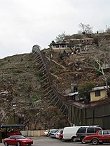
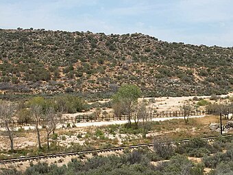
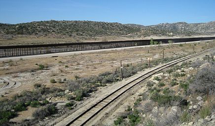
The Mexico–United States border (Spanish: frontera Estados Unidos–México) is an international border separating Mexico and the United States, extending from the Pacific Ocean in the west to the Gulf of Mexico in the east. The border traverses a variety of terrains, ranging from urban areas to deserts. The Mexico–U.S. border is the most frequently crossed border in the world with approximately 350 million documented crossings annually. Illegal crossing of the border to enter the United States has been a top issue in the States and is causing a border crisis. It is one of two international borders that the United States has, the other being the Canada–United States border to the north. It is the tenth-longest border between two countries in the world.
For the physical barrier separating the two countries, see Mexico–United States barrier.Mexico–United States border
3,145 kilometers (1,954 mi)
April 18, 1972
Boundary Treaty of 1970
The total length of the continental border is 3,145 kilometers (1,954 miles). From the Gulf of Mexico, it follows the course of the Rio Grande (Río Bravo del Norte) to the border crossing at Ciudad Juárez, Chihuahua, and El Paso, Texas. Westward from El Paso–Juárez, it crosses vast tracts of the Chihuahuan and Sonoran deserts to the Colorado River Delta and San Diego–Tijuana, before reaching the Pacific Ocean.[1]
Four American states border Mexico: California, Arizona, New Mexico and Texas. One definition of Northern Mexico includes only the six Mexican states that border the U.S.: Baja California, Chihuahua, Coahuila, Nuevo León, Sonora and Tamaulipas.[2]
The Mexico–United States border extends 3,145 kilometers (1,954 miles), in addition to the maritime boundaries of 29 km (18 mi) into the Pacific Ocean and 19 km (12 mi) into the Gulf of Mexico.[3][4] It is the tenth-longest border between two countries in the world.[5]
The Mexico–U.S. border begins at the Initial Point of Boundary Between U.S. and Mexico, which is set one marine league (three nautical miles) south of the southernmost point of San Diego Bay. The border then proceeds for 227 km (141 mi) in a straight line towards the confluence of the Colorado River and Gila River.[6][7] The border continues southwards along the Colorado River for 39 km (24 mi), until it reaches a point 32 km (20 mi) south of the Gila River confluence. The border then follows a series of lines and parallels totaling 859 km (534 mi). First, it follows a straight line from the Colorado River to the intersection of the 31° 20′ parallel north and the 111th meridian west. It then proceeds eastwards along the 31° 20′ parallel north up to a meridian 161 km (100 mi) west of the point where the Rio Grande crosses the 31° 47′ parallel north,[7] It then proceeds northwards along that meridian up to the 31° 47′ parallel north and then eastwards along that parallel until it meets the Rio Grande.[8]
According to the International Boundary and Water Commission,[9] the continental border then follows the middle of the Rio Grande—according to the 1848 Treaty of Guadalupe Hidalgo between the two nations, "along the deepest channel" (also known as the thalweg)—a distance of 2,020 km (1,255 mi) to its mouth at the Gulf of Mexico.[7] The Rio Grande frequently meanders along the Texas–Mexico border. As a result, the U.S. and Mexico have a treaty by which the Rio Grande is maintained as the border, with new cut-offs and islands being transferred to the other nation as necessary. The Boundary Treaty of 1970 between Mexico and the U.S. settled all outstanding boundary disputes and uncertainties related to the Rio Grande border.
The U.S. states along the border, from west to east, are California, Arizona, New Mexico, and Texas. The Mexican states along the border are Baja California, Sonora, Chihuahua, Coahuila, Nuevo León, and Tamaulipas. Among the U.S. states, Texas has the longest stretch of the border with Mexico, while California has the shortest. Among the states in Mexico, Chihuahua has the longest border with the U.S., while Nuevo León has the shortest. Along the border are 23 U.S. counties and 39 Mexican municipalities.


