Rabaul
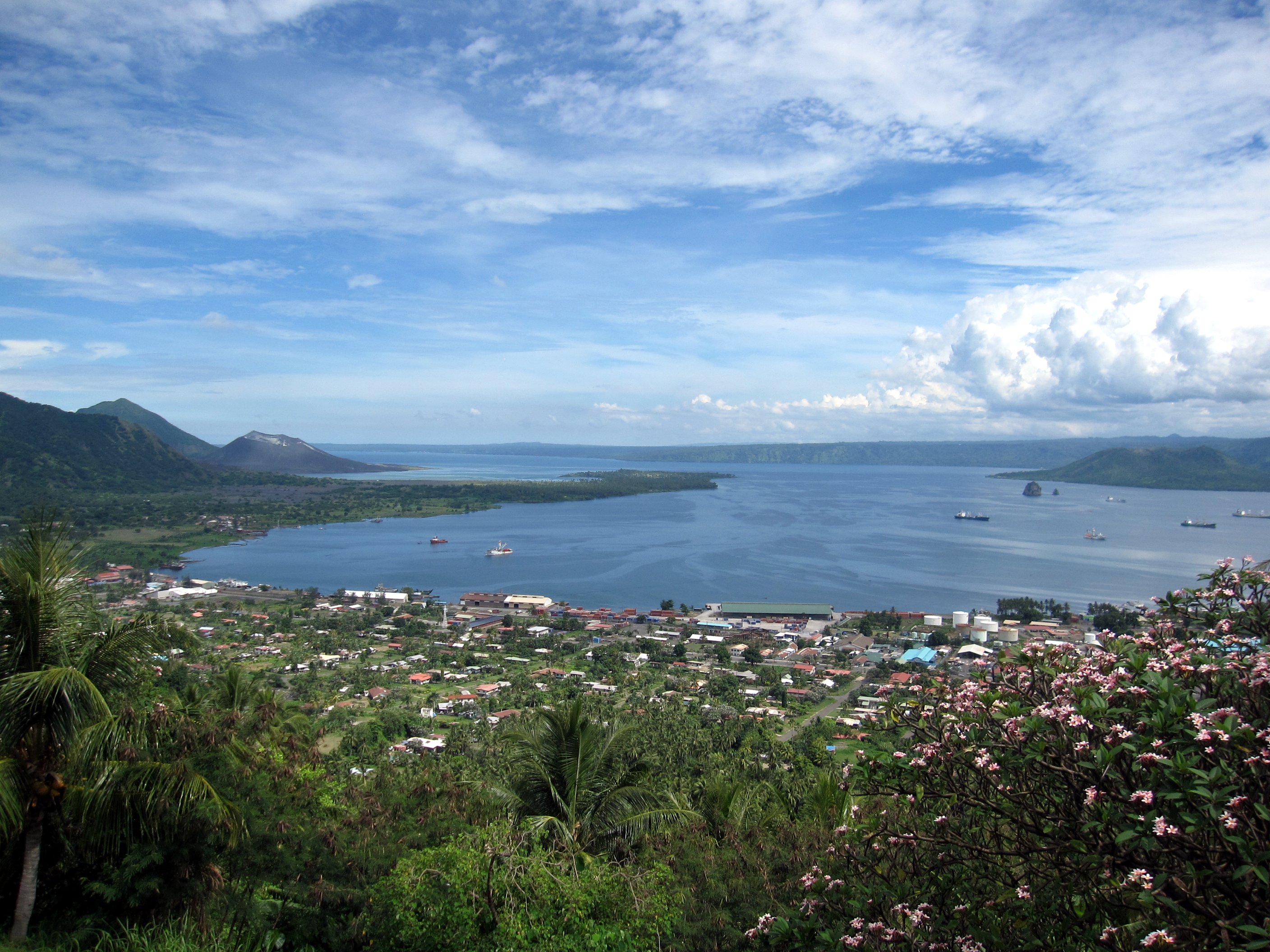
Rabaul (/rɑːˈbaʊl/) is a township in the East New Britain province of Papua New Guinea, on the island of New Britain. It lies about 600 kilometres to the east of the island of New Guinea. Rabaul was the provincial capital and most important settlement in the province until it was destroyed in 1994 by falling ash from a volcanic eruption in its harbor. During the eruption, ash was sent thousands of metres into the air, and the subsequent rain of ash caused 80% of the buildings in Rabaul to collapse. After the eruption the capital was moved to Kokopo, about 20 kilometres (12 mi) away. Rabaul is continually threatened by volcanic activity, because it is on the edge of the Rabaul caldera, a flooded caldera of a large pyroclastic shield.
For the volcanic caldera within which Rabaul lies, see Rabaul caldera. For the patrol vessel, see HMPNGS Rabaul (P01).
Rabaul
Rabaul was planned and built around the harbour area known as Simpsonhafen (Simpson Harbour) during the German New Guinea administration, which controlled the region from 1884 and formally through 1919. Rabaul was selected as the capital of the German New Guinea administration in 1905, and the administrative offices were transferred there in 1910.[2] Rabaul was captured by the British Empire during the early days of World War I.[3] It became the capital of the Australian-mandated Territory of New Guinea until 1937, when it was first destroyed by a volcano.[4] During World War II, it was captured by Japan in 1942 and became its main base of military and naval activity in the South Pacific. Settlements and military installations around the edge of the caldera are often collectively called Rabaul, although the old town of Rabaul was reduced to practical insignificance by the volcanic eruption in 1937.
As a tourist destination, Rabaul is popular for its volcanoes, scuba diving and for snorkelling sites, spectacular harbour and other scenery, World War II history, flora and fauna, and the cultural life of the Tolai people. Before the 1994 eruption, Rabaul was a popular commercial and recreational boating destination; fewer private small craft visit now, but 10 to 12 cruise ships visit Rabaul each year, including the Queen Elizabeth, carrying up to 2,000 passengers. Tourism is a major industry in Rabaul and East New Britain generally.
Transport[edit]
Rabaul Airport was destroyed in the 1994 eruption, and, since the approach involved flying over the Tavurvur crater, it was abandoned. The airport was in the direct path of the falling ash from the nearby vents. A new airport was built at Tokua, about 50 km farther away to the southeast. However, even it has been closed occasionally by ash thrown up by Tavurvur and driven by the northwest monsoon winds.
Rabaul has a large, nearly enclosed harbour, Simpson Harbour. Use of this harbour by the Imperial Japanese Navy was one of the motivations for the Japanese invasion in 1942.


