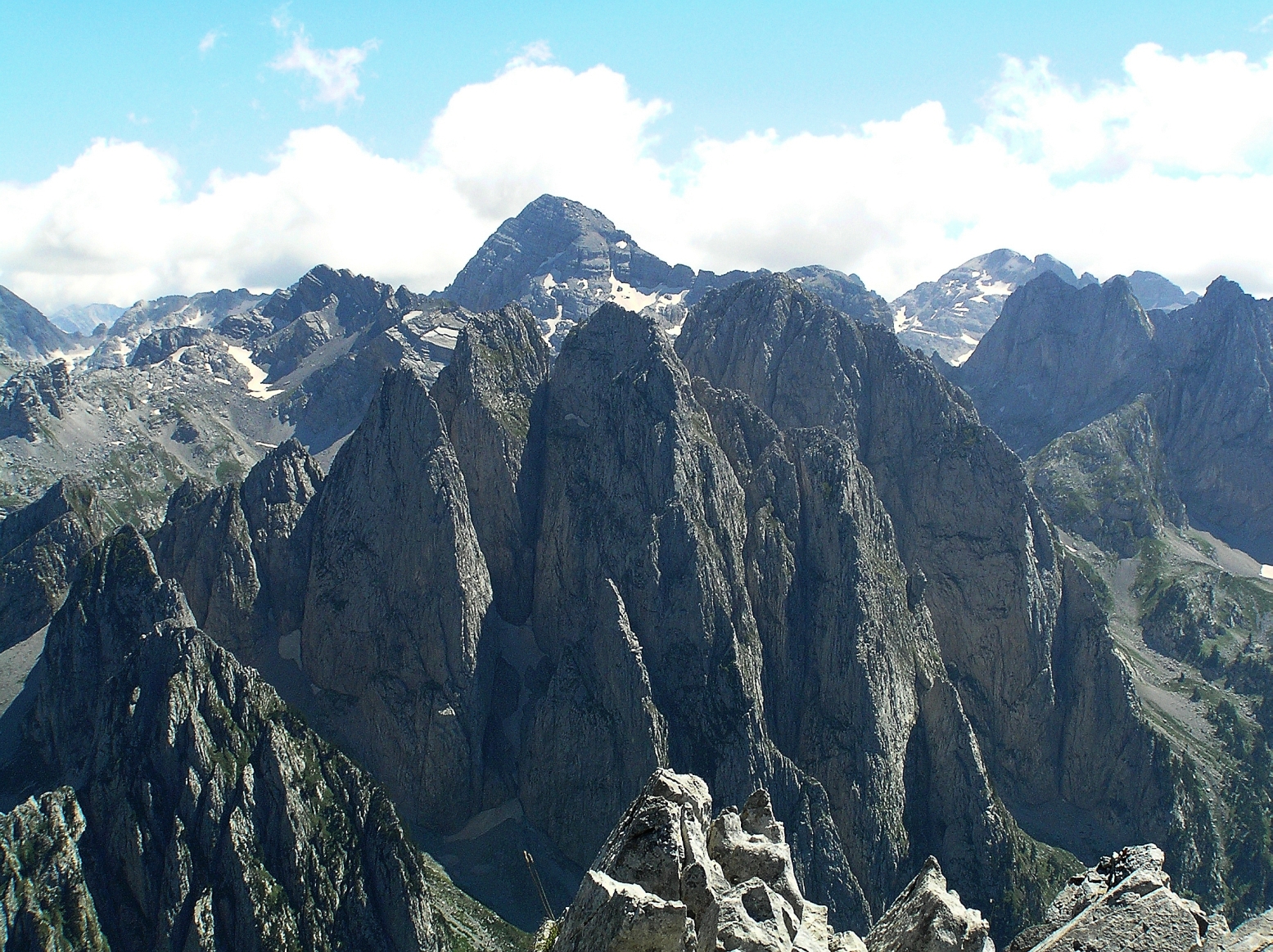
Accursed Mountains
The Accursed Mountains (Albanian: Bjeshkët e Nëmuna; Serbo-Croatian: Проклетије, Prokletije, pronounced [prɔklɛ̌tijɛ]; both translated as "Cursed Mountains"), also known as the Albanian Alps (Albanian: Alpet Shqiptare), is a mountain range in coastal Southeast Europe adjacent to the Adriatic Sea. It is the southernmost subrange of the 1,000-kilometre-long (621 mi) Dinaric Alps range (Dinarides), extending from northern Albania to southern Kosovo and northeastern Montenegro. Maja Jezercë, standing at 2,694 m (8,839 ft), is the highest point of the Accursed Mountains and of all Dinaric Alps, and the fifth highest peak in Albania. The range includes the mountain Zla Kolata, which, at 2,534 m (8,314 ft), is the tallest mountain in Montenegro. The range also includes the mountain Gjeravica, which, at 2,656 m (8,714 ft), is the second tallest mountain in Kosovo. One of the southernmost glacial masses in Europe was discovered in the Albanian part of the range in 2009.[1]
Accursed Mountains
2,694 m (8,839 ft)
- Bjeshkët e Nëmuna (Albanian)
- Проклетије / Prokletije (Serbo-Croatian)
Name[edit]
The origin of the name "Accursed Mountains" is disputed. According to one local legend, the devil escaped from hell and created the jagged glacial karsts in a single day of mischief. Others say a woman cursed the mountains while she and her children trekked through them on a scorching-hot day and could not find any water. A third legend claims Slavic soldiers gave the mountains their name as they struggled to march through them.[2]
Both the Albanian (Bjeshkët e Nëmuna) and Serbo-Croatian (Prokletije) names mean "cursed (mountains)".[3][4]
Peaks over 2,600 m (8,530 ft)
Peaks over 2,500 m (8,202 ft)
Peaks over 2,400 m (7,874 ft)
Peaks under 2,400 m (7,874 ft)
Early climbing[edit]
British climbers Sleeman, Elmalie and Ellwood were the first to reach the summit of Maja Jezercë on 26 July 1929.[27] Years later Austrian mountaineers also scaled the summit. Many explorers and scientists have visited the Accursed Mountains, collecting rocks and samples to display in museums. Before any of these expeditions, the highest peak of the range was believed to be Shkëlzen at 2,407 m (7,897 ft) high, followed by Maja Radohimës at 2,570 m (8,432 ft). By early summer 1929 all the summits were measured by Italian geodetes.