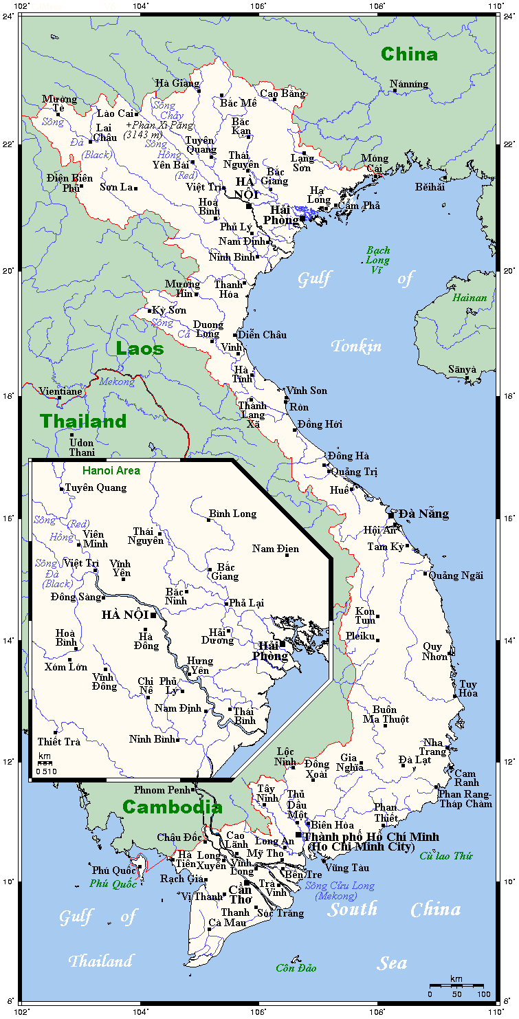
Geography of Vietnam
Vietnam is located on the eastern margin of the Indochinese peninsula and occupies about 331,211.6 square kilometres (127,881.5 sq mi), of which about 25% was under cultivation in 1987. It borders the Gulf of Tonkin, Gulf of Thailand, and Pacific Ocean, along with China, Laos, and Cambodia. The elongated roughly S shaped country has a north-to-south distance of 1,650 km (1,030 mi) and is about 50 km (31 mi) wide at the narrowest point. With a coastline of 3,260 km (2,030 mi), excluding islands, Vietnam claims 12 nautical miles (22.2 km; 13.8 mi) as the limit of its territorial waters, an additional 12 nautical miles (22.2 km; 13.8 mi) as a contiguous customs and security zone. It has an exclusive economic zone of 417,663 km2 (161,261 sq mi) with 200 nautical miles (370.4 km; 230.2 mi).
Continent
Asia
16°00′N 108°00′E
331,212 km2 (127,882 sq mi)
93.62%
6.38%
3,444 km (2,140 mi)
4,639 km (2,883 mi)
Fansipan
3,144 metres (10,315 ft)
South China Sea
0 metres (0 ft)
Đồng Nai river (longest inland river)
586 kilometres (364 mi)
Ba Bể Lake 6.5 square kilometres (2.5 sq mi)
417,663 km2 (161,261 sq mi)
The boundary with Laos was settled on both an ethnic and geographical basis between the rulers of Vietnam and Laos in the mid-seventeenth century. The Annamite Range as a reference, was formally defined by a delimitation treaty signed in 1977 and ratified in 1986. The frontier with Cambodia, defined at the time of French annexation of the western part of the Mekong Delta in 1867, remained essentially unchanged, according to Hanoi, until some unresolved border issues were finally settled in the 1982–85 period. The land and sea boundary with China, delineated under the France-China treaties of 1887 and 1895, is "the frontier line" accepted by Hanoi. China agreed in 1957–58 to respect that border line. However, in February 1979, following the Sino-Vietnamese War, Hanoi complained that from 1957 onward China had provoked numerous border incidents as part of its anti-Vietnam policy and expansionist designs in Southeast Asia. Among the territorial infringements cited was the Chinese occupation in January 1974 of the Paracel Islands, claimed by both countries in a dispute left unresolved in the 1980s.
16°00′N 108°00′E / 16.000°N 108.000°E
Physiography[edit]
The country is divided into the highlands and the Hong River Delta in the north, the Annamite Range along with the coastal lowlands in the centre, and the Mekong Delta in the south.