Isle of Arran
The Isle of Arran[7] (/ˈærən/; Scottish Gaelic: Eilean Arainn) or simply Arran is an island off the west coast of Scotland. It is the largest island in the Firth of Clyde and the seventh-largest Scottish island, at 432 square kilometres (167 sq mi). Historically part of Buteshire, it is in the unitary council area of North Ayrshire. In the 2011 census it had a resident population of 4,629. Though culturally and physically similar to the Hebrides, it is separated from them by the Kintyre peninsula. Often referred to as "Scotland in Miniature", the Island is divided into highland and lowland areas by the Highland Boundary Fault and has been described as a "geologist's paradise".[8]
This article is about the Scottish island. For other uses, see Arran.Scottish Gaelic name
Arran has been continuously inhabited since the early Neolithic period. Numerous prehistoric remains have been found. From the 6th century onwards, Goidelic-speaking peoples from Ireland colonised it and it became a centre of religious activity. In the troubled Viking Age, Arran became the property of the Norwegian crown, until formally absorbed by the kingdom of Scotland in the 13th century. The 19th-century "clearances" led to significant depopulation and the end of the Gaelic language and way of life. The economy and population have recovered in recent years, the main industry being tourism. However, the increase in tourism and people buying holiday homes on the Island, the second highest rate of such homes in the UK, has led to a shortage of affordable homes on the Island.[9] There is a diversity of wildlife, including three species of tree endemic to the area.
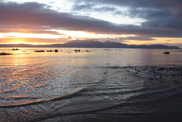
The Island includes miles of coastal pathways, numerous hills and mountains, forested areas, rivers, small lochs and beaches. Its main beaches are at Brodick, Whiting Bay, Kildonan, Sannox and Blackwaterfoot.
Etymology[edit]
Most of the islands of Scotland have been occupied consecutively by speakers of at least four languages since the Iron Age. Therefore, the names of many islands have more than one possible origin, including Arran. Mac an Tàilleir (2003) says the name "is said to be unrelated" to those of Arranmore or the Aran Islands in Ireland, which come from Irish Árainn meaning "kidney-shaped", though he does not rule out this derivation.[10]
Unusually for a Scottish island, Haswell-Smith (2004) and William Cook Mackenzie (1931) offer a Brythonic derivation and a meaning of "high place" (c.f. Middle Welsh aran) which at least corresponds with the geography – Arran is significantly loftier than all the land that immediately surrounds it along the shores of the Firth of Clyde.[8][11]
Any other Brythonic place-names that may have existed, save perhaps for Mayish,[12] were later replaced on Arran as the Goidelic-speaking Gaels spread from Ireland, via their adjacent kingdom of Dál Riata.
During the Viking Age it became, along with most Scottish islands, the property of the Norwegian crown, at which time it may have been known as "Herrey" or "Hersey". As a result of this Norse influence, many current place-names on Arran are of Viking origin.[13]
Geology[edit]
The division between the "Highland" and "Lowland" areas of Arran is marked by the Highland Boundary Fault which runs north east to south west across Scotland.[21] Arran is a popular destination for geologists, who come to see intrusive igneous landforms such as sills and dykes, and sedimentary and meta-sedimentary rocks ranging in age from Precambrian to Mesozoic.
Most of the interior of the northern half of the island is taken up by a large granite batholith that was created by substantial magmatic activity around 58 million years ago in the Paleogene period.[22] This comprises an outer ring of coarse granite and an inner core of finer grained granite, which was intruded later. This granite was intruded into the Late Proterozoic to Cambrian metasediments of the Dalradian Supergroup. Other Paleogene igneous rocks on Arran include extensive felsic and composite sills in the south of the island, and the central ring complex, an eroded caldera system surrounded by a near-continuous ring of granitic rocks.[23]
Sedimentary rocks dominate the southern half of the island, especially Old and New Red Sandstone. Some of these sandstones contain fulgurites – pitted marks that may have been created by Permian lightning strikes.[21] Large aeolian sand dunes are preserved in Permian sandstones near Brodick, showing the presence of an ancient desert. Within the central complex are subsided blocks of Triassic sandstone and marl, Jurassic shale, and even a rare example of Cretaceous chalk.[24][25] During the 19th century barytes was mined near Sannox. First discovered in 1840, nearly 5,000 tons were produced between 1853 and 1862. The mine was closed by the 11th Duke of Hamilton on the grounds that it "spoiled the solemn grandeur of the scene" but was reopened after the First World War and operated until 1938 when the vein ran out.[26]
Visiting in 1787, the geologist James Hutton found his first example of an unconformity to the north of Newton Point near Lochranza, which provided evidence for his Plutonist theories of uniformitarianism and about the age of the Earth. This spot is one of the most famous places in the study of geology.[27][28]
The Pleistocene glaciations almost entirely covered Scotland in ice, and Arran's highest peaks may have been nunataks at this time.[21] After the last retreat of the ice at the close of the Pleistocene epoch sea levels were up to 70 metres (230 ft) lower than at present and it is likely that circa 14,000 BP the island was connected to mainland Scotland.[29] Sea level changes and the isostatic rise of land makes charting post-glacial coastlines a complex task, but it is evident that the island is ringed by post glacial raised beaches.[30] King's Cave on the south west coast is an example of an emergent landform on such a raised beach. This cave, which is over 30.5 metres (100 ft) long and up to 15.3 metres (50 ft) high, lies well above the present day sea level.[31][32][33] There are tall sea cliffs to the north east including large rock slides under the heights of Torr Reamhar, Torr Meadhonach and at Scriden (An Scriodan) at the far north end of the island.[19][34][35]
The island also has the highest concentration of pitchstone sources in the United Kingdom, with approximately 100 documented sources of it on the island.[36]
Climate[edit]
The influence of the Atlantic Ocean and the Gulf Stream create a mild oceanic climate. Temperatures are generally cool, averaging about 6 °C (43 °F) in January and 16 °C (61 °F) in July at sea level.[37] The southern half of the island, being less mountainous, has a more favourable climate than the north, and the east coast is more sheltered from the prevailing winds than the west and south.
Snow seldom lies at sea level and frosts are less frequent than on the mainland. As in most islands of the west coast of Scotland, annual rainfall is generally high at between 1,500 mm (59 in) in the south and west and 1,900 mm (75 in) in the north and east. The mountains are wetter still with the summits receiving over 2,550 mm (100 in) annually. May and June are the sunniest months, with upwards of 200 hours of bright sunshine being recorded on average.[37]
Health services[edit]
NHS Ayrshire and Arran is responsible for the provision of health services for the island. Arran War Memorial Hospital is a 17-bed acute hospital at Lamlash. The Arran Medical Group provides primary-care services and supports the hospital. The practice is based at Brodick Health Centre and has three base surgeries and four branch surgeries.[69]
Popular culture[edit]
The Scottish Gaelic dialect of Arran died out when the last speaker Donald Craig died in the 1970s. However, there is now a Gaelic House in Brodick, set up at the end of the 1990s. Brodick Castle features on the Royal Bank of Scotland £20 note and Lochranza Castle was used as the model for the castle in The Adventures of Tintin, volume seven, The Black Island.
Arran has one newspaper, The Arran Banner. It was listed in the Guinness Book of Records in November 1984 as the "local newspaper which achieves the closest to a saturation circulation in its area". The entry reads: "The Arran Banner, founded in 1974, has a readership of more than 97 per cent in Britain's seventh largest off-shore island."[91] There is also an online monthly publication called Voice for Arran, which mainly publishes articles contributed by community members.[92]
In 2010 an "Isle of Arran" version of the game Monopoly was launched.[93]
The knitting style used to create Aran sweaters is often mistakenly associated with the Isle of Arran rather than the Irish Aran Islands.[94]
Arran landscapes have been the inspiration for numerous famous artists including Cragie Aitchison, Joan Eardley, Jessie M King , and Samuel Peploe.[95][96][97] ”The Isle Of Arran” is a song by British rapper Loyle Carner.
Arran features in The Scottish Chiefs by Jane Porter[98]
and Michael Peinkofer's children book series "Gryphony" is set on the island.[99]