Katana VentraIP

Muhammad al-Idrisi

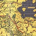
Abu Abdullah Muhammad al-Idrisi al-Qurtubi al-Hasani as-Sabti, or simply al-Idrisi /ælɪˈdrs/ (Arabic: أبو عبد الله محمد الإدريسي القرطبي الحسني السبتي; Latin: Dreses; 1100–1165), was a Muslim geographer and cartographer who served in the court of King Roger II at Palermo, Sicily. Muhammad al-Idrisi was born in Ceuta, then belonging to the Almoravid dynasty. He created the Tabula Rogeriana, one of the most advanced medieval world maps.

"Edrisi" redirects here. For places in Iran, see Edrisi, Iran.

Muhammad al-Idrisi

1100 (1100)

Ceuta, Almoravid dynasty (present-day Spain)

1165 (aged 64–65)

Ceuta, Almohad Caliphate (present-day Spain)

Geographer, writer, scientist, cartographer

Early life[edit]

Al-Idrisi was born into the Hammudid dynasty of North Africa and Al-Andalus. A descendent of Muhammad via the powerful Idrisid dynasty.[1][2] Al-Idrisi was believed to be born the city of Ceuta in 1100, at the time controlled by the Almoravids, where his great-grandfather had been forced to settle after the fall of Hammudid Málaga to the Zirids of Granada.[3] He spent much of his early life travelling through North Africa and Al-Andalus (Muslim Spain and Portugal of the times) and seems to have acquired detailed information on both regions. He visited Anatolia when he was barely 16. He studied in the university in Córdoba.[1] His travels took him to many parts of Europe including Portugal, the Pyrenees, the French Atlantic coast, Hungary, and Jórvík (now known as York).

Medical dictionary[edit]

Among the lesser known works of al-Idrisi is a medical dictionary that he compiled in which he brings down a list of simple drugs and plants and their curative effects, used by physicians, apothecaries and merchants in his day.[23] The list is unique, as it includes the names of drugs in as many as 12 languages (among which are Spanish, Berber, Latin, Greek and Sanskrit), including some sixty Hebrew terms transliterated into Arabic and which are thought to have been passed down to him by Andalusian Jewish informants. At the end of the section on medicinal herbs which are described under each letter of the alphabet, he gives an index of their entries.[24] One of the books of herbal medicine frequently cited by al-Idrisi is Marwan ibn Ganah's Kitāb al-Talḫīṣ,[25] who in turn had been influenced by the Andalusian physician Ibn Juljul.[26]

Al-Idrisi was the main character in 's book entitled A Sultan in Palrmo.

Tariq Ali

Al-Idrisi is a major character in 's 1926 opera King Roger.

Karol Szymanowski

Al-Idrisi is a supporting character in 's novel The Map of Salt and Stars[27]

Zeyn Joukhadar

In 2019, Factum Foundation created an interpretation of Al-Idrisi's world map, a silver disk 2m in diameter based on the maps contained in the 's copy of the Nuzhat al-Mushtaq.[1]

Bodleian Library

Another version, huge resolution

Another version, huge resolution

Al-Idrisi's map of the Indian Ocean.

Al-Idrisi's map of the Indian Ocean.

Al-Idrisi's map of North West Persia what is modern day Iranian Azerbaijan and the Caspian Sea.

Al-Idrisi's map of North West Persia what is modern day Iranian Azerbaijan and the Caspian Sea.

Al-Idrisi's map of the northern shoreline of Marmara Region.

Al-Idrisi's map of the northern shoreline of Marmara Region.

Al-Idrisi's map of the Balkans.

Al-Idrisi's map of the Balkans.

Al-Idrisi's map of the Balkans.

Al-Idrisi's map of the Balkans.

Al-Idrisi's map of the Iberian Peninsula.

Al-Idrisi's map of the Iberian Peninsula.

Al-Idrisi's map of the Iberian Peninsula.

Al-Idrisi's map of the Iberian Peninsula.

Al-Idrisi's description of Finland

Al-Idrisi's description of Finland

Map of the Senegal River according to al-Idrisi.

Map of the Senegal River according to al-Idrisi.

Al-Bakri

Ibn Jubayr

Abu al-Salt

History of cartography

Islamic geography

List of scientists

(1911). "Idrisi" . Encyclopædia Britannica. Vol. 14 (11th ed.). pp. 289–290.

Beazley, Charles Raymond

Beeston, A.F.L. (1950), "Idrisi's Account of the British Isles", Bulletin of the School of Oriental and African Studies, 13 (2): 265–280, :10.1017/S0041977X00083464, JSTOR 609275, S2CID 162817057.

doi

Edrisi (1866), , translated by R. Dozy; M.J. de Goeje, Leiden: E.J. Brill.

Description de l'Afrique et de l'Espagne

Oman, G. (1971), , Encyclopaedia of Islam Volume 3 (2nd ed.), Leiden: Brill, pp. 1032–1035.

"Al-Idrīsī"

Ahmad, S. Maqbul (2008) [1970–80], , Complete Dictionary of Scientific Biography, Encyclopedia.com.

"Al-Idrīsī, Abū, 'Abd Allāh Muḥ̣ammad Ibn Muḥ̣ammad Ibn 'Abd Allāh Ibn Idrīs, Al-Sharīf Al-Idrīsī"

Britannica

Bibliothèque nationale de France (French)

Online exhibition

Library of Congress. Konrad Miller's 1927 consolidation and transliteration, with high-resolution zoom browser.

Idrisi's world map

High resolution images of works by al-Idrisi in .jpg and .tiff format.

Online Galleries, History of Science Collections, University of Oklahoma Libraries

IDRISI GIS home page

features English translations of work by al-Idrisi. The manuscript dates from 1738.

"Travels into the Inland Parts of Africa: Containing a Description of the Several Nations for the Space of Six Hundred Miles up the River Gambia"

Original Nuzhatul Mushtaq text