Persian Gulf
The Persian Gulf (Persian: خلیج فارس, romanized: xalij-e fârs, lit. 'Gulf of Fars', pronounced [xæliːdʒe fɒːɾs]), sometimes called the Arabian Gulf (Arabic: اَلْخَلِيْجُ ٱلْعَرَبِيُّ, romanized: Al-Khalīj al-ˁArabī), is a mediterranean sea in West Asia. The body of water is an extension of the Indian Ocean located between Iran and the Arabian Peninsula.[1] It is connected to the Gulf of Oman in the east by the Strait of Hormuz. The Shatt al-Arab river delta forms the northwest shoreline.
This article is about the body of water. For other uses, see Persian Gulf (disambiguation) and Arabian Gulf (disambiguation).Persian Gulf
Gulf
989 km (615 mi)
251,000 km2 (97,000 sq mi)
50 m (160 ft)
90 m (300 ft)
8,780 km3 (2,100 cu mi)
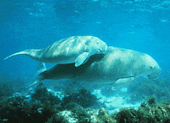
The Persian Gulf has many fishing grounds, extensive reefs (mostly rocky, but also coral), and abundant pearl oysters, however its ecology has been damaged by industrialization and oil spills.
The Persian Gulf is in the Persian Gulf Basin, which is of Cenozoic origin and related to the subduction of the Arabian Plate under the Zagros Mountains.[2] The current flooding of the basin started 15,000 years ago due to rising sea levels of the Holocene glacial retreat.[3]
Oceanography
The Persian Gulf is connected to the Indian Ocean through the Strait of Hormuz. Writing the water balance budget for the Persian Gulf, the inputs are river discharges from Iran and Iraq (estimated to be 2,000 cubic metres (71,000 cu ft) per second), as well as precipitation over the sea which is around 180 mm (7.1 in)/year in Qeshm Island. The evaporation of the sea is high, so that after considering river discharge and rain contributions, there is still a deficit of 416 cubic kilometres (100 cu mi) per year.[8] This difference is supplied by currents at the Strait of Hormuz. The water from the Persian Gulf has a higher salinity, and therefore exits from the bottom of the Strait, while ocean water with less salinity flows in through the top. Another study revealed the following numbers for water exchanges for the Persian Gulf: evaporation = –1.84 m (6.0 ft)/year, precipitation = 0.08 m (0.26 ft)/year, inflow from the Strait = 33.66 m (110.4 ft)/year, outflow from the Strait = -32.11 m (105.3 ft)/year, and the balance is 0 m (0 ft)/year.[9] Data from different 3D computational fluid mechanics models, typically with spatial resolution of 3 kilometres (1.9 mi) and depth each element equal to 1–10 metres (3.3–32.8 ft) are predominantly used in computer models.
History
Ancient history
The region of the Persian Gulf has been inhabited since the Paleolithic.[27] During most of the Last Glacial Period (115,000–11,700 years Before Present), due to lowered sea levels (reaching around 125 metres (410 ft) metres below present values during the Last Glacial Maximum) combined with the shallow depth of the Gulf (on average around 35 metres (115 ft) and at max around 100 metres (330 ft) metres depth) most of the Persian Gulf was exposed as dry land,[28] forming a flat floodplain where a number of rivers converged. This region may have served as an environmental refuge for early humans during periodic hyperarid climate oscillations. The modern marine Gulf was formed when sea level rose during the early Holocene, from around 12,000 to 6,000 years ago. The flooding of the Gulf may have stimulated the development of Neolithic farming cultures in regions of the Middle East adjacent to the Gulf.[27]


