Katana VentraIP

Arabian Peninsula

The Arabian Peninsula[1] (/əˈrbiən .../; Arabic: شِبْهُ الْجَزِيرَة الْعَرَبِيَّة, shibhu l-jazīra l-ʿarabiyya, "Arabian Peninsula" or جَزِيرَةُ الْعَرَب, jazīratu l-ʿarab, "Island of the Arabs"),[2] or Arabia, is a peninsula in West Asia, situated northeast of Africa on the Arabian Plate. At 3,237,500 km2 (1,250,000 sq mi), comparable in size to India, the Arabian Peninsula is the largest peninsula in the world.[3][4][5][6][7]

"Arabia" and "Arabian" redirect here. For other uses, see Arabia (disambiguation) and Arabian (disambiguation).

Area

3,237,500 km2 (1,250,000 sq mi)

95,000,000 (2023 estimate )

29.0/km2

0.788 (2018)
high

Geographically, the Arabian Peninsula includes Bahrain,[a] Kuwait, Oman, Qatar, Saudi Arabia, the United Arab Emirates (UAE) and Yemen, as well as southern Iraq and Jordan.[8] The largest of these is Saudi Arabia.[9] In the classical era, the Sinai Peninsula was also considered a part of Arabia.


The Arabian Peninsula formed as a result of the rifting of the Red Sea between 56 and 23 million years ago, and is bordered by the Red Sea to the west and southwest, the Persian Gulf and the Gulf of Oman to the northeast, the Levant and Mesopotamia to the north and the Arabian Sea and the Indian Ocean to the southeast. The peninsula plays a critical geopolitical role in the Arab world and globally due to its vast reserves of oil and natural gas.


Before the modern era, the region was divided into primarily four distinct regions: the Central Plateau (Najd and Al-Yamama), South Arabia (Yemen, Hadhramaut and Oman), Al-Bahrain (Eastern Arabia or Al-Hassa), and the Hejaz (Tihamah for the western coast), as described by Ibn al-Faqih.[10]

("Stony Arabia"[11]): it consisted of the former Nabataean Kingdom in the southern Levant, the Sinai Peninsula and northwestern Arabian Peninsula. It was the only one that became a province, with Petra (in Jordan) as its capital.

Arabia Petraea

("Desert Arabia"): signified the desert lands of Arabia. As a name for the region, it remained popular into the 19th and 20th centuries, and was used in Charles M. Doughty's Travels in Arabia Deserta (1888).

Arabia Deserta

("Fortunate Arabia"): was used by geographers to describe the southern part of the Arabian peninsula, mostly what is now Yemen, which enjoys more rainfall, is much greener than the rest of the peninsula and has long enjoyed much more productive fields.

Arabia Felix

In antiquity, the term "Arabia" encompassed a larger area than the current term "Arabian Peninsula" and included the Arabian desert and large parts of the Syrian-Arabian desert. During the Hellenistic period, the area was known as Arabia or Aravia (Greek: Αραβία). The Romans named three regions with the prefix "Arabia".


The Arab inhabitants used a north–south division of Arabia: Al Sham-Al Yaman, or Arabia Deserta-Arabia Felix. Arabia Felix had originally been used for the whole peninsula, and at other times only for the southern region. Because its use became limited to the south, the whole peninsula was simply called Arabia. Arabia Deserta was the entire desert region extending north from Arabia Felix to Palmyra and the Euphrates, including all the area between Pelusium on the Nile and Babylon. This area was also called Arabia and not sharply distinguished from the peninsula.[12]


The Arabs and the Ottoman Empire considered the west of the Arabian Peninsula region where the Arabs lived 'the land of the Arabs' – Bilad al-'Arab (Arabia), and its major divisions were the bilad al-Sham (Levant), bilad al-Yaman (Yemen), and Bilad al-'Iraq (Iraq).[13] The Ottomans used the term Arabistan in a broad sense for the region starting from Cilicia, where the Euphrates river makes its descent into Syria, through Palestine, and on through the remainder of the Sinai and Arabian peninsulas.[14]


The provinces of Arabia were: Al Tih, the Sinai peninsula, Hejaz, Asir, Yemen, Hadramaut, Mahra and Shilu, Oman, Hasa, Bahrain, Dahna, Nufud, the Hammad, which included the deserts of Syria, Mesopotamia and Babylonia.[15][16]

Northeast: The , of UAE and Oman[30]

Hajar range

Southeast: The of southern Oman,[30] contiguous with the eastern Yemeni Hadhramaut[34][35]

Dhofar Mountains

West: Bordering the of the Red Sea are the Sarawat,[28] which can be seen to include the Haraz Mountains to the east of Yemen,[29] as well as those of 'Asir (once part of Yemen) [36] and Hejaz[37][38] the latter including the Midian in what is now northwestern Saudi Arabia[34]

eastern coast

Northwest: Aside from the Sarawat, the northern portion of Saudi Arabia hosts the , which include the Aja and Salma subranges[30]

Jabal Shamar Mountains

Central: The Najd hosts the Escarpment[34] or Tuwair range[30]

Tuwaiq

Ain Zubaydah was built to water the pilgrims in Mecca, Saudi Arabia by order of Zubaidah bint Ja'far

Ain Zubaydah was built to water the pilgrims in Mecca, Saudi Arabia by order of Zubaidah bint Ja'far

The facade of a tomb with its details and architectural elements in Hegra, Saudi Arabia.

The facade of a tomb with its details and architectural elements in Hegra, Saudi Arabia.

Qasr al Farid, tomb in Archeological site Mada'in Saleh, Al-`Ula, Saudi Arabia

Qasr al Farid, tomb in Archeological site Mada'in Saleh, Al-`Ula, Saudi Arabia

Diriyah the capital of the first Saudi state

Diriyah the capital of the first Saudi state

Himyarite King Dhamar'ali Yahbur II

Himyarite King Dhamar'ali Yahbur II

Arad Fort in Bahrain

Arad Fort in Bahrain

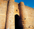
Nizwa Fort in Oman

Nizwa Fort in Oman

The ruins of Umayyad city in the historic Jumeirah district of Dubai.

The ruins of Umayyad city in the historic Jumeirah district of Dubai.

Bull's head, made of copper in the early period of Dilmun (ca. 2000 BC), Bahrain.

Bull's head, made of copper in the early period of Dilmun (ca. 2000 BC), Bahrain.

The head and body of a Saluki is made of stone from the Al-Magar civilization, in the Neolithic period, (about 8000 BC).

The head and body of a Saluki is made of stone from the Al-Magar civilization, in the Neolithic period, (about 8000 BC).

1892

Travels in Arabia

Archived 14 July 2014 at the Wayback Machine

High resolution scan of old map of Arabia

from the World Digital Library, depicts a map from 1707.

The Coast of Arabia the Red Sea, and Persian Sea of Bassora Past the Straits of Hormuz to India, Gujarat and Cape Comorin

Wahab, Robert Alexander; Thatcher, Griffithes Wheeler; (1911). "Arabia" . Encyclopædia Britannica (11th ed.).

Goeje, Michael Jan de

Arabia: Cultural-Historical Zones

Eran Laor Cartographic Collection, The National Library of Israel

Old maps of Arabia