
San Juan, Metro Manila
San Juan, officially the City of San Juan (Filipino: Lungsod ng San Juan), is a 1st class highly urbanized city in the National Capital Region of the Philippines. According to the 2020 census, it has a population of 126,347 people.[4] It is geographically located at Metro Manila's approximate center and is also the country's smallest city in terms of land area.
San Juan
none
1623
October 12, 1903
March 27, 1907
June 17, 2007
21 (see Barangays)
Jose Angelo Rafael E. Agcaoili (PDP–Laban)
Ysabel Maria J. Zamora (PDP–Laban)
109,640 voters (2022)
5.87 km2 (2.27 sq mi)
145th out of 145
24 m (79 ft)
136 m (446 ft)
0 m (0 ft)
126,347
22,000/km2 (56,000/sq mi)
31,519
San Juaneño (Male)
San Juaneña (Female)
1st city income class
₱ 2,338 million (2020)
₱ 6,327 million (2020)
₱ 1,823 million (2020)
₱ 2,398 million (2020)
Manila Electric Company (Meralco)
+63 (0)02
Tagalog
The city is known historically for the site of the first battle of the Katipunan, the organization which led the 1896 Philippine Revolution against the Spanish Empire. Notable landmarks today such as Pinaglabanan Shrine and heritage homes are located in the city. Other locations include Greenhills and Santolan Town Plaza, making the city a major shopping hub with a range of upscale, boutique and bargain retail.[6]
Etymology[edit]
"San Juan" is a contraction of the city's traditional name of "San Juan del Monte" (lit. 'Saint John of the Mountain'). As with numerous other places in the Philippines, the name combines a patron saint and a toponym; in this case Saint John the Baptist with the locale's hilly terrain and relatively higher elevation compared to surrounding areas.
The city's official name is "Dakilang Lungsód ng San Juan" (lit. 'Great City of San Juan').
History[edit]
Early history[edit]
During the pre-Hispanic period, the area of what is now San Juan was a part of the Kingdom of Namayan, whose last recorded rulers were King Lakan Tagkan and his consort, Bouan.[7]
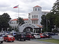
The San Juan Government Center along Pinaglabanan Street corner Doctor P. A. Narciso Street in Barangay Corazon de Jesus
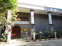
Santuario del Santo Cristo

The old municipal hall of San Juan, with the San Juan Medical Center in the background.

Virra Mall, one of many shopping areas in the Greenhills mixed-use development.


Commercial establishments along the city's main road, Nicanor Domingo Street.

