Katana VentraIP

Quezon City

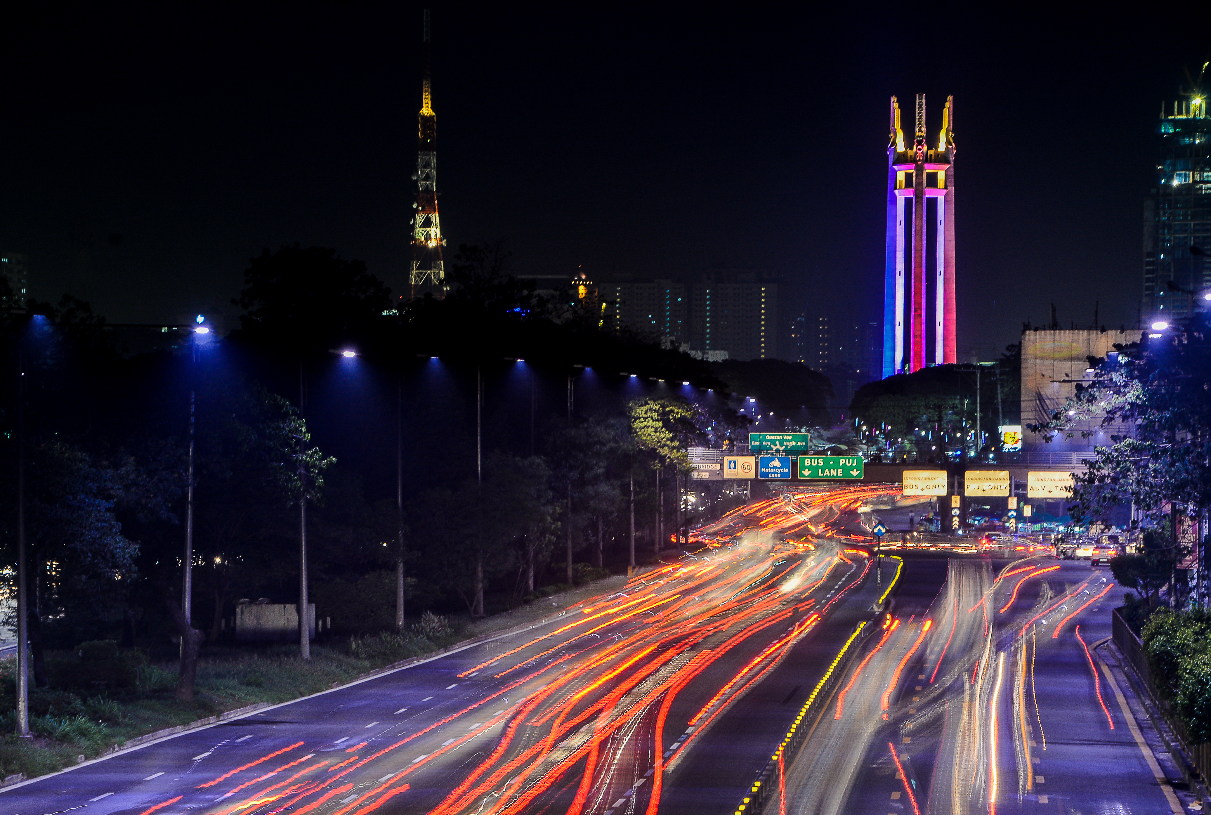
Quezon City (UK: /ˈkzɒn/, US: /ˈksɒn, -sɔːn, -sn/;[9][10][11][12] Filipino: Lungsod Quezon [luŋˈsod ˈkɛson] ), also known as the City of Quezon and Q.C. (read and pronounced in Filipino as Kyusi),[13][14][15] is the most populous city in the Philippines. According to the 2020 census, it has a population of 2,960,048 people. It was founded on October 12, 1939, and was named after Manuel L. Quezon, the second president of the Philippines.

This article is about the city in Metro Manila. For other uses, see Quezon (disambiguation).

Quezon City
Lungsod Quezon

none

October 12, 1939

December 22, 1979

142 (see Barangays)

Joy Belmonte (SBP)

Gian Sotto (SBP)

Councilors

1,403,895 voters (2022)

171.71 km2 (66.30 sq mi)

67 m (220 ft)

796 m (2,612 ft)

−2 m (−7 ft)

2,960,048

1st

17,000/km2 (45,000/sq mi)

738,724

Taga-QC
QCitizen

special city income class

2.45
% (2018)[7]

₱ 24,024 million (2020)

₱ 451,589 million (2020)

₱ 23,068 million (2020)

₱ 29,660 million (2020)

Manila Electric Company (Meralco)

1100 to 1138[8]

+63 (0)2

The city was intended to be the national capital of the Philippines that would replace Manila, as the latter was suffering from overcrowding, lack of housing, poor sanitation, and traffic congestion. To create Quezon City, several barrios were carved out from the towns of Caloocan, Marikina, San Juan and Pasig, in addition to the eight vast estates the Philippine government purchased for this purpose. It was officially proclaimed the national capital on October 12, 1949, and several government departments and institutions moved out of Manila and settled into the new capital city. This necessitated the expansion of the city northward, carving out Novaliches from Caloocan which divided it into two non-contiguous parts. Several barrios were also taken from San Mateo and parts of Montalban. However, on June 24, 1976, Presidential Decree No. 940 was enacted, which reverted national capital status to Manila while the whole of Metro Manila was designated as the seat of government.[16][17] The city was also chosen as the regional center of Southern Tagalog, which was created in 1965, along with the provinces of Quezon and Aurora, the birthplace of Manuel L. Quezon; however, its status of regional center became ineffective when the region was divided into Calabarzon and Mimaropa, through the effect of Executive Order No. 103 in May 2002 under the presidency of Gloria Macapagal Arroyo, and Aurora was transferred to the authority of Central Luzon, with Southern Tagalog limited to being a cultural-geographic region.[18]


Quezon City is known for its culture, entertainment industry and media, and is aptly called the "City of Stars". Major broadcasting networks have their headquarters and studios in the city. It is also known for its commerce, education, research, technology, politics, tourism, art and sports. Several national government branches including the Batasang Pambansa Complex, the seat of House of Representatives of the Philippines, calls the city home.


Quezon City is a planned city. It covers a total area of 161.11 square kilometers (62.20 sq mi),[5] making it the largest city in Metro Manila in terms of land area. It is politically subdivided into Six Congressional Districts, which represents the city in the Lower House of the Congress of the Philippines. The city has 142 barangays under the City Government. National government departments and agencies are mostly situated at the first National Government Center (NGC) in Diliman and the second National Government Center in Batasan Hills, where the Lower House of the Philippine Congress is located. Most of the city's northern part lies at the foothills of the Sierra Madre mountain range, including the La Mesa Watershed Reservation, the largest watershed in Metro Manila and a designated protected area.


According to its 2023 estimated census, Quezon City had 3.1 million people in its boundaries, and 93.8 billion dollars in its GDP, and it is the only planned city in the NCR region.

(2015 population: 409,962)[70] covers barangays Alicia, Bagong Pag-asa, Bahay Toro, Balingasa, Bungad, Damar, Damayan, Del Monte, Katipunan, Mariblo, Masambong, N.S. Amoranto (Gintong Silahis), Nayong Kanluran, Paang Bundok, Pag-ibig sa Nayon, Paltok, Paraiso, Phil-Am, Ramon Magsaysay, Salvacion, San Antonio, San Isidro Labrador, San Jose, Santa Cruz, Santa Teresita, Santo Cristo, Talayan, Veterans Village and West Triangle. It has an area of 19.59 km2 (7.56 sq mi).[71]

District I

(2015 population: 688,773)[70] covers barangays Bagong Silangan, Batasan Hills, Commonwealth, Holy Spirit and Payatas. It is the most populous district in the country from 1987 to 2013, before it was partitioned and its northern part became the 5th District and its western part became the 6th District.

District II

(2015 population: 324,669)[70] covers barangays Amihan, Bagumbuhay, Bagumbayan, Bayanihan, Blue Ridge A, Blue Ridge B, Camp Aguinaldo, Claro, Dioquino Zobel, Duyan-Duyan, E. Rodriguez, East Kamias, Escopa I, Escopa II, Escopa III, Escopa IV, Libis, Loyola Heights, Mangga, Marilag, Masagana, Matandang Balara, Milagrosa, Pansol, Quirino 2-A, Quirino 2-B, Quirino 2-C, Quirino 3-A, Saint Ignatius, San Roque, Silangan, Socorro, Tagumpay, Ugong Norte, Villa Maria Clara, West Kamias and White Plains.

District III

(2015 population: 446,122)[70] covers barangays Bagong Lipunan ng Crame, Botocan, Central, Kristong Hari, Damayang Lagi, Doña Aurora, Doña Imelda, Doña Josefa, Don Manuel, East Triangle, Horseshoe, Immaculate Conception, Kalusugan, Kamuning, Kaunlaran, Krus na Ligas, Laging Handa, Malaya, Mariana, Obrero, Old Capitol Site, Paligsahan, Pinyahan, Pinagkaisahan, Roxas, Sacred Heart, San Isidro Galas, San Martin de Porres, San Vicente, Santo Niño, Santol, Sikatuna Village, South Triangle, Tatalon, Teachers Village East, Teachers Village West, U.P. Campus, U.P. Village and Valencia.

District IV

(2015 population: 535,798)[70] covers barangays Bagbag, Capri, Fairview, Greater Lagro, Gulod, Kaligayahan, Nagkaisang Nayon, North Fairview, Novaliches Proper, Pasong Putik Proper, San Agustin, San Bartolome, Santa Lucia and Santa Monica. It is more commonly known as Novaliches.

District V

(2015 population: 531,592)[70] covers barangays Apolonio Samson, Baesa, Balon-Bato, Culiat, New Era, Pasong Tamo, Sangandaan, Sauyo, Talipapa, Tandang Sora and Unang Sigaw.

District VI

Cubao: Located at the southern part of the city, Cubao is the home of the 35-hectare , a mixed-use township development that contains prominent shopping malls such as Ali Mall, Farmers Plaza and Gateway Mall and iconic landmarks such as the Smart Araneta Coliseum. The Cubao Cathedral is the seat of the Roman Catholic Diocese of Cubao.

Araneta City

Diliman: Diliman is located at the center of Quezon City, the place where the city was originally established. Named for the word for the medicinal fern species Stenochlaena palustris,[75][76] Diliman is where numerous national government offices are located, as well as prominent colleges and universities such as the University of the Philippines Diliman, FEU–FERN College, and New Era University. The Diliman Quadrangle, which is bounded by the North, West, South (Timog) and East Avenues is known for its massive hospitals and government edifices, bars, nightlife, and media. Several streets in South Triangle and Laging Handa were named in honor of the 22 Boy Scouts who died in the plane crash en route to joining the 11th World Scout Jamboree. A memorial stands in the center of the roundabout at the intersection of Timog and Tomas Morato Avenues. The place was known as the Scout Area. Major commercial broadcasting media and television networks such as ABS-CBN have their headquarters here. PTV, RPN, IBC, and PBS also hold headquarters in Diliman.

Tagalog

La Loma: La Loma is located the southwestern portion of the city. It has five barangays along the vicinity of its main streets: N.S. Amoranto Avenue (Retiro) and A. Bonifacio Avenue. The district is famed as the birthplace of many popular Filipino culinary figures and establishments especially devoted to the . The nearby La Loma Cemetery is named after this place.

lechon

: New Manila is named after the City of Manila, since most of its residents are affluent families from the city who wished to escape the stress of living in the capital. It was formerly a part of San Juan before being carved out from its mother town to form Quezon City. Among its notable residents are the Hemady-Ysmael Family, the original landowner of New Manila, and Dona Narcisa de Leon, the matriarch of LVN Studios. It is also the birthplace of Eraño Manalo, the Second Executive Minister of Iglesia ni Cristo.[77] New Manila is also known for Balete Drive, which a haunted place according to Filipino folklore where the spirit of a white lady haunts the road seeking help from passing drivers.

New Manila

: Novaliches is the largest district in Quezon City, which made up almost all the northern portion of the city after Batasan Hills. It contains the La Mesa Watershed Reservation and its Dam and Reservoir where most of Metro Manila's water supply came from. It was originally a part of Caloocan before being incorporated to Quezon City in 1948, when the latter was declared as the capital. Before the place was incorporated to Quezon City in 1948, Novaliches was already in the maps as early as 1864, having been organized by the Spanish as early as 1855, from the haciendas of Tala, Malinta, Piedad, and Maysilo. By 1856, it was its own municipality before being absorbed by Caloocan in 1901. Novaliches is still known by its historical boundaries. The whole of North Caloocan up to the banks of the Marilao River bordering Bulacan to the north, parts of the historic Polo section of Valenzuela to the west, and parts of San Jose del Monte, Bulacan to the upper reaches of Tungkung Mangga and the old Tala Leprosarium in the northeast and east, are still referred to as within the old enclave of Novaliches that many residents consider to this day.

Novaliches

Project 1: Also known as Barangay Roxas or Roxas District.

Project 2: Made up of barangays Quirino 2-A, Quirino 2-B and Quirino 2-C.

Project 3: Made up of barangays Quirino 3-A, Amihan, Claro and Duyan-Duyan.

Project 4: Located within the eastern area beside Cubao.

Project 5: Also known as Barangay E. Rodriguez.

: Project 6 in Diliman is an affluent barangay which is known for hospitals such as the Philippine Children's Medical Center (PCMC) and the Veterans Memorial Medical Center (VMMC), as well as the home of Philippine Science High School Main Campus. The Office of the Ombudsman and the Ninoy Aquino Parks and Wildlife Center are located here.

Project 6

Project 7: Project 7 is made up of barangays and Veterans Village.

Bungad

Project 8: Project 8 is made up of barangays Bahay Toro, Baesa and Sangandaan.

: San Francisco del Monte was founded as a pueblo by Saint Pedro Bautista in 1590, is considered as Quezon City's oldest district. The original land area of the old town was approximately 2.5 square kilometers (1.0 sq mi), including parts of Project 7 and 8 and Timog Avenue. It is bounded by West Avenue on the east, Epifanio De Los Santos Avenue on the north, Quezon Avenue on the south, and Araneta Avenue on the west. It was originally a part of San Juan, before it was carved out of its mother town to form Quezon City. The district is made up of barangays San Antonio, Paraiso, Paltok, Mariblo, Masambong, Manresa, Damayan and Del Monte. SFDM featured a hilly topography with lush vegetation and mineral springs, in the midst of which the old Santuario de San Pedro Bautista was built as a retreat and monastery for Franciscan friars. The headquarters of IBC is located here.

San Francisco del Monte

Santa Mesa Heights: Santa Mesa Heights is an affluent neighborhood where many middle-class and upper-middle-class families reside. It is mostly residential. It is the home to the and the National Shrine of Our Lady of La Naval. Prominent Catholic educational institutions such as the Angelicum College, Lourdes School of Quezon City, and St. Theresa's College of Quezon City are located here. During the Commonwealth Period, Santa Mesa Heights was considered as the ideal site for universities, located just outside the suburban city limits of Manila.

National Shrine of Our Lady of Lourdes

Capital of the Philippines

Manila

Manuel L. Quezon

Quezon Province

Quezon City Government, Milestones in History, 2014.

Encyclopædia Britannica – Quezon City Topic

Official website

Quezon City General Information

Philippine Standard Geographic Code

Geographic data related to at OpenStreetMap

Quezon City