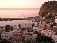
Mediterranean Sea
The Mediterranean Sea (/ˌmɛdɪtəˈreɪniən/ MED-ih-tə-RAY-nee-ən) is a sea connected to the Atlantic Ocean, surrounded by the Mediterranean Basin and almost completely enclosed by land: on the north by Southern Europe and Anatolia, on the south by North Africa, and on the east by the Levant in West Asia. The Mediterranean has played a central role in the history of Western civilization. Geological evidence indicates that around 5.9 million years ago the Mediterranean was cut off from the Atlantic and was partly or completely desiccated over a period of some 600,000 years during the Messinian salinity crisis before being refilled by the Zanclean flood about 5.3 million years ago.
"Mediterranean" redirects here. For other uses, see Mediterranean (disambiguation).Mediterranean Sea
- Albania
- Algeria
- Bosnia and Herzegovina
- Croatia
- Cyprus
- Egypt
- France
- Greece
- Israel
- Italy
- Lebanon
- Libya
- Malta
- Monaco
- Montenegro
- Morocco
- Northern Cyprus (recognized only by Turkey, see Cyprus dispute)
- Palestine
- Slovenia
- Spain
- Syria
- Tunisia
- Turkey
- United Kingdom (Akrotiri and Dhekelia and Gibraltar)
- For other countries, see §Hydrography
2,500,000 km2 (970,000 sq mi)
1,500 m (4,900 ft)
5,109 m (16,762 ft) ±1 m (3 ft)
3,750,000 km3 (900,000 cu mi)
80–100 years[1]
28 °C (82 °F)
12 °C (54 °F)
The Mediterranean Sea covers an area of about 2,500,000 km2 (970,000 sq mi),[2] representing 0.7% of the global ocean surface, but its connection to the Atlantic via the Strait of Gibraltar—the narrow strait that connects the Atlantic Ocean to the Mediterranean Sea and separates the Iberian Peninsula in Europe from Morocco in Africa—is only 14 km (9 mi) wide. The Mediterranean Sea encompasses a vast number of islands, some of them of volcanic origin. The two largest islands, in both area and population, are Sicily and Sardinia.
The Mediterranean Sea has an average depth of 1,500 m (4,900 ft) and the deepest recorded point is 5,109 m (16,762 ft) ±1 m (3 ft) in the Calypso Deep in the Ionian Sea. It lies between latitudes 30° and 46° N and longitudes 6° W and 36° E. Its west–east length, from the Strait of Gibraltar to the Gulf of Alexandretta, on the southeastern coast of Turkey, is about 4,000 kilometres (2,500 mi). The north–south length varies greatly between different shorelines and whether only straight routes are considered. Also including longitudinal changes, the shortest shipping route between the multinational Gulf of Trieste and the Libyan coastline of the Gulf of Sidra is about 1,900 kilometres (1,200 mi). The water temperatures are mild in winter and warm in summer and give name to the Mediterranean climate type due to the majority of precipitation falling in the cooler months. Its southern and eastern coastlines are lined with hot deserts not far inland, but the immediate coastline on all sides of the Mediterranean tends to have strong maritime moderation.
The sea was an important route for merchants and travellers of ancient times, facilitating trade and cultural exchange between the peoples of the region. The history of the Mediterranean region is crucial to understanding the origins and development of many modern societies. The Roman Empire maintained nautical hegemony over the sea for centuries and is the only state to have ever controlled all of its coast.
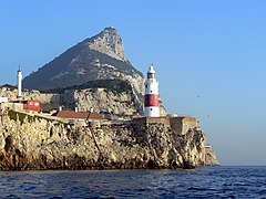
The countries surrounding the Mediterranean and its marginal seas in clockwise order are Spain, France, Monaco, Italy, Slovenia, Croatia, Bosnia and Herzegovina, Montenegro, Albania, Greece, Turkey, Syria, Lebanon, Israel, Palestine, Egypt, Libya, Tunisia, Algeria, and Morocco; Malta and Cyprus are island countries in the sea. In addition, Gibraltar, an overseas territory of the United Kingdom, is located on the coast of the Mediterranean. The drainage basin encompasses a large number of other countries, the Nile being the longest river ending in the Mediterranean Sea.[3]
Biogeochemistry[edit]
In spite of its great biodiversity, concentrations of chlorophyll and nutrients in the Mediterranean Sea are very low, making it one of the most oligotrophic ocean regions in the world. The Mediterranean Sea is commonly referred to as an LNLC (Low-Nutrient, Low-Chlorophyll) area. The Mediterranean Sea fits the definition of a desert in which its nutrient contents are low, making it difficult for plants and animals to develop.
There are steep gradients in nutrient concentrations, chlorophyll concentrations and primary productivity in the Mediterranean. Nutrient concentrations in the western part of the basin are about double the concentrations in the eastern basin. The Alboran Sea, close to the Strait of Gibraltar, has a daily primary productivity of about 0.25 g C (grams of carbon) m−2 day−1 whereas the eastern basin has an average daily productivity of 0.16 g C m−2 day−1.[92] For this reason, the eastern part of the Mediterranean Sea is termed "ultraoligotrophic". The productive areas of the Mediterranean Sea are few and small. High (i.e. more than 0.5 grams of Chlorophyll a per cubic meter) productivity occurs in coastal areas, close to the river mouths which are the primary suppliers of dissolved nutrients. The Gulf of Lion has a relatively high productivity because it is an area of high vertical mixing, bringing nutrients to the surface waters that can be used by phytoplankton to produce Chlorophyll a.[93]
Primary productivity in the Mediterranean is also marked by an intense seasonal variability. In winter, the strong winds and precipitation over the basin generate vertical mixing, bringing nutrients from the deep waters to the surface, where phytoplankton can convert it into biomass.[94] However, in winter, light may be the limiting factor for primary productivity. Between March and April, spring offers the ideal trade-off between light intensity and nutrient concentrations in surface for a spring bloom to occur. In summer, high atmospheric temperatures lead to the warming of the surface waters. The resulting density difference virtually isolates the surface waters from the rest of the water column and nutrient exchanges are limited. As a consequence, primary productivity is very low between June and October.[95][93]
Oceanographic expeditions uncovered a characteristic feature of the Mediterranean Sea biogeochemistry: most of the chlorophyll production does not occur on the surface, but in sub-surface waters between 80 and 200 meters deep.[96] Another key characteristic of the Mediterranean is its high nitrogen-to-phosphorus ratio (N:P). Redfield demonstrated that most of the world's oceans have an average N:P ratio around 16. However, the Mediterranean Sea has an average N:P between 24 and 29, which translates a widespread phosphorus limitation.[97][98][99][100]
Because of its low productivity, plankton assemblages in the Mediterranean Sea are dominated by small organisms such as picophytoplankton and bacteria.[101][102]
Paleoclimate[edit]
Because of its latitude and its landlocked position, the Mediterranean is especially sensitive to astronomically induced climatic variations, which are well documented in its sedimentary record. Since the Mediterranean is subject to the deposition of eolian dust from the Sahara during dry periods, whereas riverine detrital input prevails during wet ones, the Mediterranean marine sapropel-bearing sequences provide high-resolution climatic information. These data have been employed in reconstructing astronomically calibrated time scales for the last 9 Ma of the Earth's history, helping to constrain the time of past geomagnetic reversals.[117] Furthermore, the exceptional accuracy of these paleoclimatic records has improved our knowledge of the Earth's orbital variations in the past.
