
Portuguese India
The State of India (Portuguese: Estado da Índia [ɨʃˈtaðu ðɐ ˈĩdiɐ]), also referred as the Portuguese State of India (Portuguese: Estado Português da India, EPI) or simply Portuguese India (Portuguese: Índia Portuguesa), was a state of the Portuguese Empire founded six years after the discovery of a sea route to the Indian subcontinent by Vasco da Gama, a subject of the Kingdom of Portugal. The capital of Portuguese India served as the governing centre of a string of military forts and trading posts scattered all over the Indian Ocean.
State of IndiaEstado da Índia (Portuguese)
State of Portugal (1505–1946)
Overseas province of Portugal (1946–1961)
Francisco de Almeida (first)
15 August 1505
19 December 1961
4,305 km2 (1,662 sq mi)
- Portuguese Indian rupia (INPR)
- Portuguese Indian escudo (INPES)
The first viceroy, Francisco de Almeida established his base of operations at Fort Manuel after the Kingdom of Cochin negotiated to become a protectorate of Portugal in 1505. With the Portuguese conquest of Goa from the Bijapur Sultanate in 1510, Goa became the major anchorage for the Portuguese Armadas arriving in India. The capital of the viceroyalty was transferred from Cochin, in the Malabar region, to Goa in 1530.[1][2] From 1535, Mumbai (Bombay) was a harbour of Portuguese India, known as Bom Bahia, until it was handed over, via the dowry of Catherine de Braganza to Charles II of England in 1661. The expression "State of India" began regularly appearing in documents in the mid-16th century.[3]
Until the 18th century, the viceroy at Goa had authority over all Portuguese possessions in and around the Indian Ocean, from Southern Africa to Southeast Asia. In 1752, Mozambique got its own separate government; from 1844 on, Portuguese Goa stopped administering Macao, Solor and Timor. Despite this, the viceroy at Goa only controlled limited portions of Portuguese settlements in the east; some settlements remained informal private affairs, without a captain or câmara (municipal council). By the end of the 18th century, most of these unofficial colonies were abandoned by Portugal, due to heavy competition from European and Indian rivals.[4]
In later years, Portugal's authority was confined to holdings in the Canara, Cambay & Konkan regions along the west coast of India. At the time of the dissolution of the British Raj in 1947, Portuguese India comprised three administrative divisions, sometimes referred to collectively as Goa: Goa which included Anjediva, and Damaon, which included the exclaves of Dadra and Nagar Haveli and Dio districts. The Salazar regime of Portugal lost de facto control of Dadra and Nagar Haveli in 1954. Finally, the rest of the overseas territory was lost in December 1961 with the Indian Annexation of Goa under PM Nehru. Portugal only recognised Indian control after the Carnation Revolution and the fall of the Estado Novo regime in a treaty signed on 31 December 1974.[5]


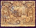
Early postal history of the colony is obscure, but regular mail is known to have been exchanged with Lisbon from 1825 onwards. Portugal had a postal convention with Great Britain, so much mail was probably routed through Bombay and carried on British packets. Portuguese postmarks are known from 1854 when a post office was opened in Goa.
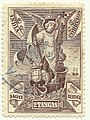
The last regular issue for Portuguese India was on 25 June 1960, for the 500th anniversary of the death of Prince Henry the Navigator. Stamps of India were first used on 29 December 1961, although the old stamps were accepted until 5 January 1962. Portugal continued to issue stamps for the lost colony but none were offered for sale in the colony's post offices, so they are not considered valid stamps.
Dual franking was tolerated from 22 December 1961 until 4 January 1962. Colonial (Portuguese) postmarks were tolerated until May 1962.
Indo-Portuguese illustration of a Portuguese nobleman and Christian Indian women, from the Códice Casanatense.

16th century Indo-Portuguese illustration of the main deities of Hinduism at the Códice Casanatense.


18th century Indo-Portuguese cabinet

Indo-Portuguese cabinet

Indo-Portuguese writing cabinet

Indo-Portuguese furniture

Indo-Portuguese pistol

17th century Indo-Portuguese Christian ivory.
